Story map: Inside Tornado Alley

NOAA’s story map takes you inside Tornado Alley to NOAA’s Norman, Okla., campus. It’s here that some of the world’s most significant scientific and technological breakthroughs are born. From the front lines of meteorology and the way forecasts are made, to a revealing look at what’s on the horizon, you’ll see how NOAA continues to change the face of weather forecasting. Catch the action in America’s heartland!

A tornado churns up dust in the sunset light near Traer, Iowa by Brad Goddard, Orion, IL

A tornado churns up dust in the sunset light near Traer, Iowa by Brad Goddard, Orion, IL (Image credit: NOAA)

All eyes on the sky

NOAA’s Norman, Okla., facility lies within Tornado Alley, one of the world’s most tornado-prone areas. In the glass-walled corridors, all eyes are on the sky. 

Many of the world's severe weather experts work in Norman. Some focus on research and keep our nation's radars running. Others forecast severe thunderstorms and tornadoes for the lower 48. NOAA forecasters cover Alaska and Hawaii in their own regions.

For Norman staff, work is personal as well as a professional passion. They know how life-changing severe weather can be. As this story map was being developed, eye-witnesses reported over 825 tornadoes tearing through the Great Plains. More advanced radar, more precise warnings, and forecasters who identified risks days in advance helped spare lives during this year's unprecedented stretch of tornado activity.

Research meteorologists from several universities are joining scientists from the NOAA National Severe Storms Laboratory for a small, mobile field project to study thunderstorms and tornadoes.
Research meteorologists from several universities join scientists from the NOAA National Severe Storms Laboratory for small, mobile field projects to study thunderstorms and tornadoes. (NOAA)
Aerial view of the National weather Center at the Universiy of Oklahoma in Norman, Okla. .... The National Weather Center houses a unique confederation of University of Oklahoma, National Oceanic and Atmospheric Administration and state organizations that work together in partnership to improve understanding of events occurring in Earth’s atmosphere over a wide range of time and space.
Aerial view of the National Weather Center at the University of Oklahoma in Norman, Okla. (NOAA)

Oklahoma spirit

Generations of Oklahomans have weathered severe storms, exhibiting the hardy resilience and enterprising, enduring spirit that helped build America's frontier and shape our young nation.

The NOAA Hazardous Weather Testbed is a joint project of the National Weather Service and the National Severe Storms Laboratory. The HWT provides a conceptual framework and a physical space to foster collaboration between research and operations to test and evaluate emerging technologies and science for NWS operations. The HWT was borne from the “Spring Program” which, for the last decade, has been used to test and evaluate new forecast models, techniques, and products to support NWS Storm Prediction
The NOAA Hazardous Weather Testbed (HWT) is a joint project of the National Weather Service and the National Severe Storms Laboratory. The HWT provides a conceptual framework and a physical space to foster collaboration between research and operations to test and evaluate emerging technologies and science for NWS operations. (NOAA)

This same spirit galvanizes NOAA's work in Norman. With many partners, NOAA continues to advance understanding of severe weather and achieve the technological breakthroughs vital to protecting lives, property and U.S. economies. 

Video showing the National Weather Center building in Norman, Okla. (NOAA)

Ahead of the storm

Most NOAA efforts are based at the National Weather Center offsite link on the University of Oklahoma campus. Three components operate within the National Weather Service: the Storm Prediction CenterWeather Forecast Office, and Warning Decision Training Division.

NOAA Research’s National Severe Storms Laboratory and the Tri-Agency Radar Operations Center and Southern Climate Impacts Planning Program offsite link are also vital components. In studying weather, NOAA often works closely with the University of Oklahoma's Cooperative Institute for Mesoscale Meteorological Studies. offsite link


What is severe weather?

Video highlighting the important variables that make up "severe weather." Examples include the following: Winds are at least 58 mph. Hail one inch or larger. Tornadoes swirl to the ground – about 1,200 strike the U.S. each year. They can occur in any state and be a mile wide. (NOAA)

Making a weather forecast
 

watch means Be Prepared!

Storm Prediction Center forecasters monitor conditions 24/7, delivering accurate and timely watches and forecasts for severe thunderstorms, tornadoes, wildfires, and winter weather, communicating risks up to eight days in advance.

Watches highlight areas at specific risk two to eight hours in advance and typically cover about 25,000 square miles.

warning means Take Action!

When danger to people and property is imminent, the National Weather Service issues a warning. Norman's Weather Forecast Office provides warnings for regions of Oklahoma and Texas.

Here's how a forecast is made:

Video highlighting how severe weather forecasts are made, featuring actions taken by both the NOAA Storm Prediction Center and local NWS Forecast office during a rare Christmas Day tornado that struck Mobile, Ala., in 2012. A strong tornado did strike the area that day, but there were no surprises. The community had a heads-up, and the tornado hit where expected. (NOAA)


The Doppler effect

In Tornado Alley, warm humid air from the Gulf of Mexico lies beneath cold dry air from the Rocky Mountains, creating an ideal environment for tornadoes to be born within thunderstorms. 

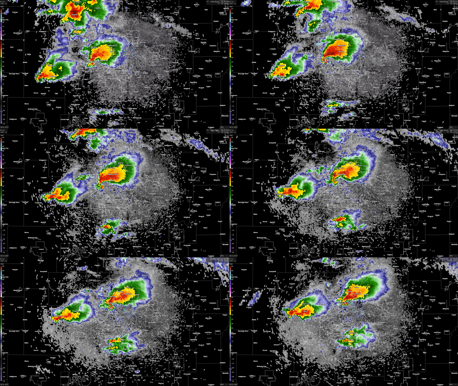
In 1973, National Severe Storms Laboratory researchers intercepted a storm in Union City, Okla., being scanned by experimental Doppler radar. By documenting the tornado's life cycle on film, they were able to compare filmed images with Doppler data, leading to the landmark discovery that, even before it showed up on film, the tornado was forming within the thunderstorm. This pattern was named the Tornado Vortex Signature

In time, NOAA deployed a national network of Doppler radars, which have since been credited with saving an untold number of lives by detecting hazardous weather, triggering tornado alerts and other warnings. 

As the devastating tornado tore through the small town of Union City, Okla., on May 24, 1973, no one knew the tremendous impact it would have on the development of weather radar. Researchers from the NOAA National Severe Storms Laboratory now look back on that day as a significant event in the history of severe weather research and forecasting.
As the devastating tornado tore through the small town of Union City, Okla., on May 24, 1973, no one knew the tremendous impact it would have on the development of weather radar. Researchers from the NOAA National Severe Storms Laboratory now look back on that day as a significant event in the history of severe weather research and forecasting. (NOAA)

Milestones in forecasting

Video showcasing milestones in severe weather forecasting. There was a time when no one knew a tornado was coming until there was devastation on the ground. As the first Doppler radar, NEXRAD changed the face of weather forecasting. The new Advanced Technology Demonstrator combines two weather prediction technologies, revealing the future of radar. Dual Polarized Radar Technology takes the radar from 2D to 3D. Phased array radar scans the skies electronically rather than mechanically, letting radar focus on a storm. (NOAA)


Mysterious twisters

A supercell thunderstorm in Kansas. (Photo by Mike Coniglio/NOAA NSSL)

Supercells, or powerful, persistent and rotating storms, are birthing grounds for the strongest tornadoes across the Great Plains. But scientists don’t yet know why some storms make tornadoes and others don't. 

OU CIMMS Researcher Elizabeth Smith preparing the LiDAR system for operation on the outskirts of a storm. (Photo by Mike Coniglio/NOAA NSSL)
NOAA/University of Oklahoma Cooperative Institute Researcher Elizabeth Smith preparing the Light Detection and Ranging (LiDAR) system for operation on the outskirts of a storm. (Photo by Mike Coniglio/NOAA NSSL)

Joined by more than 50 researchers from four universities, Norman scientists recently drove their instruments right to these dangerous storms. They're partners in TORUS, a new and ambitious field project aimed at understanding the link between tornadoes and the storms that spawn the most destructive ones. 

Windsonde launch near Norman, Okla. Windsondes are small weather balloons with attached instrumentation that can be launched every 30–60 seconds from a field vehicle, allowing researchers to have many of them in the air at once.
(Photo by Christiaan Patterson/OU CIMMS/NOAA NSSL)
Windsonde launch near Norman, Okla. Windsondes are small weather balloons with attached instrumentation that can be launched every 30–60 seconds from a field vehicle, allowing researchers to have many of them in the air at once. (Photo by Christiaan Patterson/OU CIMMS/NOAANSSL) (NOAA)

To improve forecasts, drones, mobile radars, NOAA aircraft, lidar to detect atmospheric particles, swarms of instruments tied to small weather balloons and more are observing storms, yielding a data-driven, multi-dimensional view of each storm system. 


Continuing quest for better forecasts

Video highlighting NOAA's continuing quest for better forecasts, with emphasis on the NOAA Hazardous Weather Testbed (HWT). NOAA’s Testbed is a one-of-a-kind experience for stakeholders, especially with so many advances in forecasting. Connecting the social applicability and expertise of emergency management and broadcasters to physical scientists and forecasters offers unique and critical perspectives, empowering stakeholders to work together to generate, apply and share life-saving weather hazard information. (NOAA)

A proud legacy

This radar image shows "definitive hooks," telling forecasters tornadoes are on the ground.
This radar image shows "definitive hooks," telling forecasters tornadoes are on the ground. (NOAA)

NOAA’s National Severe Storms Laboratory has improved knowledge about severe weather and pioneered advances in technology, leading to increased warning and forecast lead times and accuracy and bringing pivotal change to weather forecasting.

Each year, in the quest to improve forecasts, the lab partners with the Storm Prediction Center to host experiments in the Hazardous Weather Testbed.  In this real-time environment, forecasters and researchers strengthen their skills and sharpen their perspectives by learning more about each other’s worlds. 

As they test and evaluate emerging forecasting and warning technologies, visiting broadcasters and emergency managers share their own vital insights. 


Communicating risk

Video about communicating risk to users, such as when a tornado warning was issued after severe weather appeared on radar just north of Tuscaloosa, Ala. (NOAA)

The human element

Along with science and technology, NOAA forecasters consider the human aspects of making life-saving decisions. 

Simulating past events, the Warning Decision Training Division teaches forecasters the latest methodologies for interpreting data.  But human factors such as communications, cognitive overload and situational awareness are priorities, too.

Built on forecasting advances and an understanding of how the public responds to safety messages, FACETs is a proposed new framework for more completely communicating severe threats to help people make better decisions.

Video about communicating Risk to users. For example, NOAA's Forecasting a Continuum of Environmental Threats program (FACETs) proposes a fresh approach to communicating threats. FACETs hones in with fast, concrete, easily understood communications. FACETs helps people decide when – and when not – to take action. (NOAA)


For weather geeks

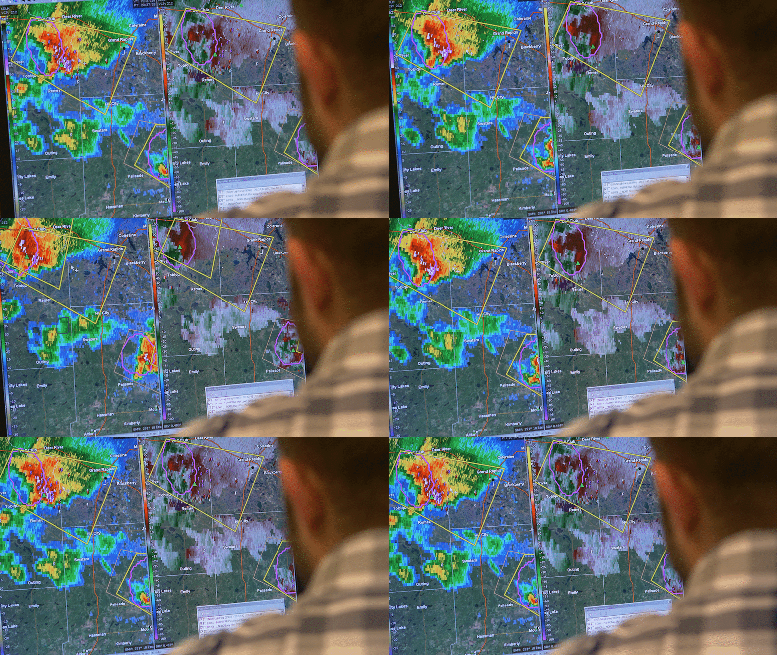
NOAA National Severe Storms Laboratory meteorologist tracking radar images showing severe weather moving east across Minnesota.
NOAA National Severe Storms Laboratory meteorologist tracking radar images showing severe weather moving east across Minnesota. (NOAA)

Step Into Wild Weather

Investigate Field Research

Discover the Power of Flash Floods

Read the Latest about Radar

See if You're at Risk Today  

Tiffany Meyer, Cooperative Institute Research Associate and NOAA Hazardous Weather Testbed Technical Advisor.
Tiffany Meyer, Cooperative Institute Research Associate and NOAA Hazardous Weather Testbed Technical Advisor at the NSSL in Norman, Okla. (NOAA)

Check out careers for meteorologists

Learn why Norman loves students

Stay weather wise with News from NOAA

Be a Weather-Ready Nation Ambassador

Join NOAA's citizen science community

NOAA's Science on a Sphere® (SOS) is a room sized, global display system that uses computers and video projectors to display planetary data onto a six foot diameter sphere, analogous to a giant animated globe.
NOAA's Science on a Sphere® (SOS) is a room-sized, global display system that uses computers and video projectors to display planetary data onto a six-foot diameter sphere, analogous to a giant animated globe. (NOAA)

Visit Science on a Sphere® (SOS)

Simulate a tornado

Reach for the clouds offsite link

Create your own rain and snow

Click on Web Weather for Kids offsite link

Video showing the outside of the National Weather Center building in Norman, Okla. (NOAA)


To view the original Inside tornado alley story map, please see this version on the ESRI website offsite link.