National Weather Service United States Department of Commerce
Ohio Valley Radar Loop
Central KY/Southern IN Radar Loop
Ohio Valley Visible Satellite Image
Ohio Valley Infrared Satellite Image
3-Day Forecast Snowfall Amounts for the state of Kentucky
3-Day Forecast Ice Accumulation Forecast for Kentucky
3-Day Forecast Snowfall Amounts for Southern IN/Central KY
3-Day Ice Accumulation Forecast for Southern IN/Central KY
Four pane snow/ice composite chart for day 1 (today), displaying the probability for 4+ inches of snow (top left), 8+ inches of snow (top right), 12+ inches of snow (bottom right), and 0.25+ inches of freezing rain (bottom right). Issued by the Weather Prediction Center.
Four pane snow/ice composite chart for day 2 (tomorrow), displaying the probability for 4+ inches of snow (top left), 8+ inches of snow (top right), 12+ inches of snow (bottom right), and 0.25+ inches of freezing rain (bottom right). Issued by the Weather Prediction Center.
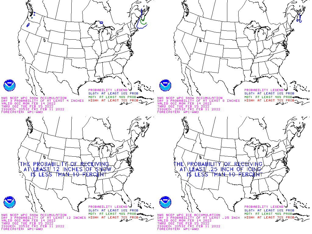
Four pane snow/ice composite chart for day 3, displaying the probability for 4+ inches of snow (top left), 8+ inches of snow (top right), 12+ inches of snow (bottom right), and 0.25+ inches of freezing rain (bottom right). Issued by the Weather Prediction Center.
This image depicts the probability of accumulating snowfall for Day 4. These graphics are issued by the Weather Prediction Center twice a day.
This image depicts the probability of accumulating snowfall for Day 5. These graphics are issued by the Weather Prediction Center twice a day.
This image depicts the probability of accumulating snowfall for Day 6. These graphics are issued by the Weather Prediction Center twice a day.
This image depicts the probability of accumulating snowfall for Day 7. These graphics are issued by the Weather Prediction Center twice a day.
Algona, IA (Kossuth County)
Big Creek Beach, IA (Polk County)
Big Creek Marina, IA (Polk County)
Cedar Falls, IA (Black Hawk County)
Creston, IA (Union County)
Fort Dodge, IA (Webster County)
ISU Ag Farm, IA (Boone County)
ISU (Ames), IA (Story County)
Jefferson, IA (Greene County)
Knoxville, IA (Marion County)
Madrid, IA (Boone County)
Newton, IA (Jasper County)
Panora, IA (Guthrie County)
Pella, IA (Marion County)
Parkersburg, IA (Butler County)
Rathbun Lake, IA (Appanoose County)
Rockwell City, IA (Calhoun County)
Stuart, IA (Guthrie County)
Tama, IA (Tama County)
Waverly, IA (Bremer County)
Winterset, IA (Madison County)
 
   
National DSS Page
Severe Weather Winter Weather

Current Weather Alerts

 
   Blizzard Warning    Snow Squall Warning 
   Winter Storm Warning    Winter Storm Watch
   Ice Storm Warning   Hazardous Weather Outlook
   Wind Chill Warning    Wind Chill Watch
   Wind Chill Advisory    Winter Weather Advisory
   High Wind Warning    Wind Advisory
   Special Weather Statement    
 
**SEND US your snow and ice reports **

Real Time Snowfall and Storm Reports
Latest Local Forecast Discussion
 

Forecast Snow and Ice Amounts

Forecast Snowfall Amounts over Southern IN/Central KY for the Next 3 Days
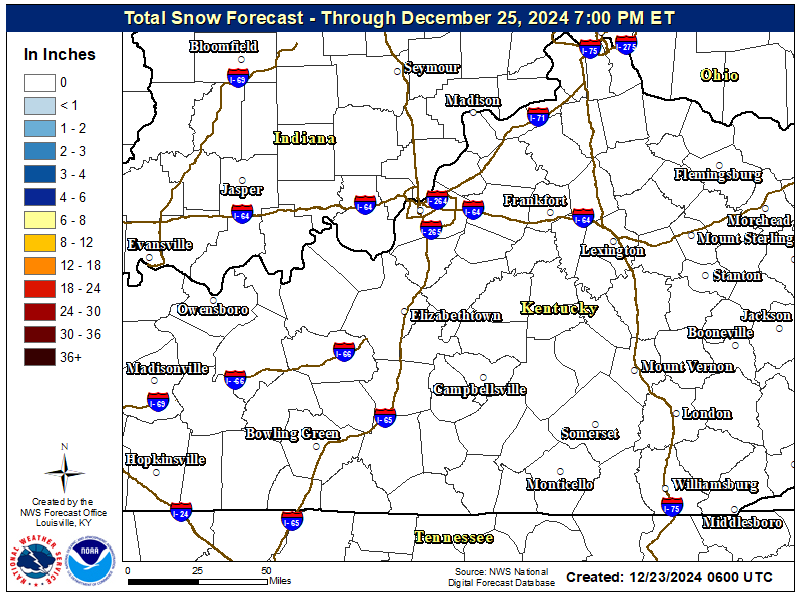
Image of Central KY/Southern IN Forecast Snowfall Amounts for the Next 3 Days

Kentucky Forecast Snowfall Amounts for
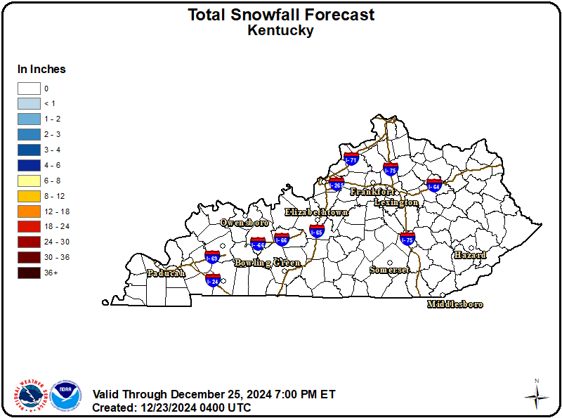
the Next 3 Days

Forecast Ice Accumulations over Southern IN/Central KY for
the Next 3 Days

Image of Central KY/Southern IN Forecast Ice Amounts for the Next 3 Days

Kentucky Forecast Ice Accumulations for
the Next 3 Days

Image of KY Forecast Ice Accumulations over the Next 3 Days


Use the slider bar below to view forecast snowfall in 6 hour increments along with other forecast parameters. The map will update automatically. Use your mouse to zoom into/pan around on the map.


2-Day Probability Graphs of Winter Precipitation

(Kentucky cites in blue, Indiana cities in red)


National Snow & Ice Probabilistic Forecasts

Click each image composite for more information.
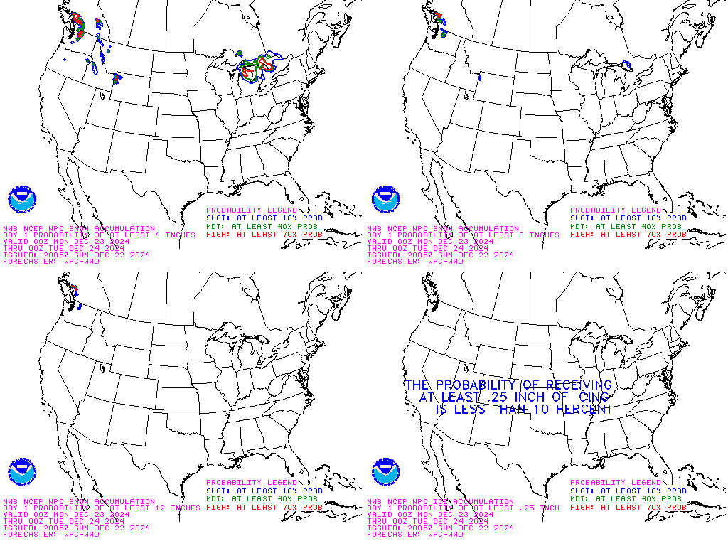
Day 1 WPC Snow and Ice Probabilistic Composite
Day 1
Day 2 WPC Snow and Ice Probabilistic Composite
Day 2
Day 3 WPC Snow and Ice Probabilistic Composite
Day 3
Day 4 Accumulating Snowfall Probabilities
Day 4
Day 5 Accumulating Snowfall Probabilities
Day 5
Day 6 Accumulating Snowfall Probabilities
Day 6
Day 7 Accumulating Snowfall Probabilities
Day 7


View an Interactive Snow and Ice Probabilistic Forecast Map


Radar and Satellite

Regional Radar Image
Ohio Valley Radar Loop
 
Central KY/Southern IN Radar Image
Central KY/Southern IN Radar Loop
 
 Visible Satellite Image
Ohio Valley Visible Satellite Image (Loop
IR Satellite Image
Ohio Valley Infrared Satellite Image (Loop

Louisville Webcams

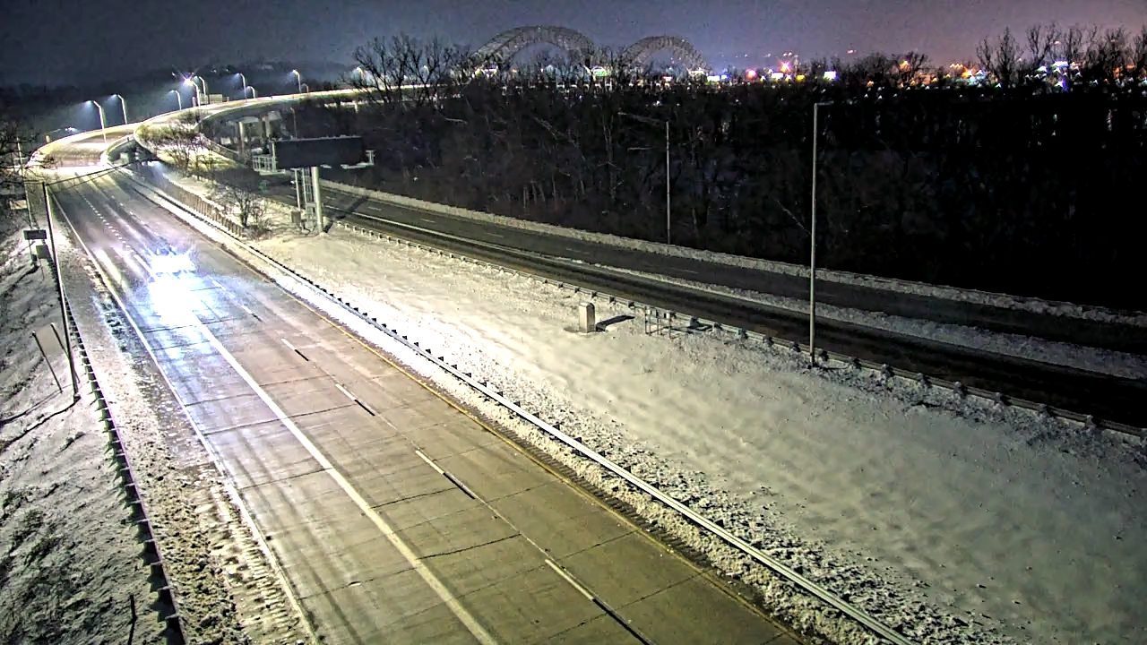
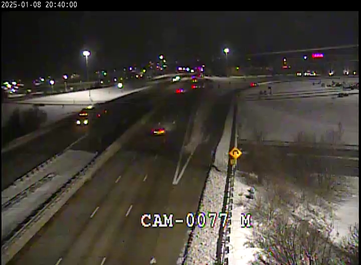
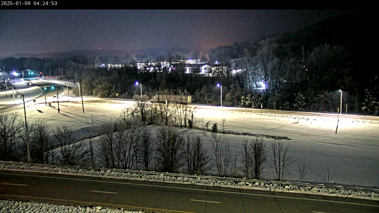
Note: Webcams are provided through third parties and may not always be up to date. Please check the time stamp on each image to ensure the image is current.

I-65 Spaghetti Junction
I-65 @ Spaghetti Junction
I-64 @ 9th Street
I-64 @ 9th Street
I-64 @ 39th Street
I-64 @ 39th Street
I-264 @ Virginia Avenue
I-264 @ Bells Lane
I-264 @ Bells Lane
I-264 @ Dixie Highway
I-65 @ I-264
I-65 @ I-264
I-65 @ Crittenden Drive
I-64 @ Cochran Hill Tunnel
I-64 @ Breckinridge Lane
I-64 @ Breck. Lane
I-64 @ I-264
I-64 @ I-264
I-264 @ Westport Road
I-71 @ I-264
I-71 @ I-264
I-265 @ Westport Road
I-265 @ Old Henry Road
I-265 @ I-64
I-265 @ I-64
I-265 @ Bardstown Road
I-265 Smyrna
I-265 @ Smyrna Road
I-265 @ I-65
I-265 @ I-65
KY 841 @ New Cut Road

Lexington/Frankfort Webcams

Note: Webcams are provided through third parties and may not always be up to date. Please check the time stamp on each image to ensure the image is current.

US127 south of FFT
US127 south of FFT
US60 @ US127 in Frankfort
US60 @ Chenault Rd in Frankfort
I-75 @ Iron Works Pike
I-75 @ Newtown Pike
I-75 @ Newtown Pike
I-75 @ Bryan Station Rd.
I-75 @ Russell Cave Rd.
I-75 @ Clays Ferry
I-75 @ Clays Ferry
I-75 @ Winchester Rd.
I-75 @ Athens Boonesboro Rd.

Elizabethtown Webcams

Note: Webcams are provided through third parties and may not always be up to date. Please check the time stamp on each image to ensure the image is current.

WKY Parkway @ E-town
I-65 @ MP 92.6
I-65 @ MP 92.6
I-65 @ MP 92.4
I-65 @ MP 92.4
I-65 @ WK Parkway
I-65 @ W KY Parkway

Bowling Green Webcams

Note: Webcams are provided through third parties and may not always be up to date. Please check the time stamp on each image to ensure the image is current.

US68 @ Russellville Rd.
Morgantown Rd @ Campbell Ln.
Morgantown Rd. @ Campbell Ln.
Natcher Parkway MP 5
US31 @ Nashville Rd.
Scottsville Rd. @ Lovers Ln.
I-65 MP 22
Natcher @ US 231
I-65 @ 234
I-65 @ 234

NWS Louisville Social Media


pFad - Phonifier reborn

Pfad - The Proxy pFad of © 2024 Garber Painting. All rights reserved.

Note: This service is not intended for secure transactions such as banking, social media, email, or purchasing. Use at your own risk. We assume no liability whatsoever for broken pages.


Alternative Proxies:

Alternative Proxy

pFad Proxy

pFad v3 Proxy

pFad v4 Proxy