A break from the frigid weather pattern is on the way
Temperatures should recover toward the freezing mark into the late week
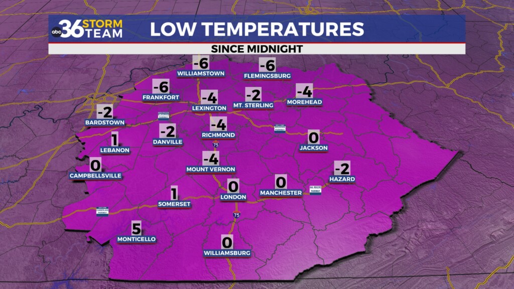
We saw our coldest morning in a year across Central and Eastern Kentucky as the center of the Arctic air mass settled right over the commonwealth. Temperatures dropped below zero in many locations thanks to the combination of clear skies, light winds and a relatively fresh snowpack that added to the chill. Officially we reached -4 in Lexington early Wednesday morning, which was the coldest temperature we’ve seen almost a year to the day when it was -7 back on January 21, 2024. We did manage to see a decent recovery through the day despite some high clouds drifting through as temperatures managed to work back into the mid-20s by the end of the day.
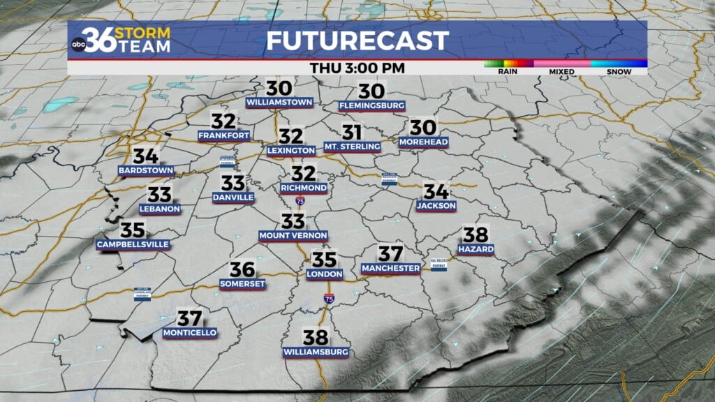
Another wave of energy and a frontal boundary will dive into the Ohio Valley late Thursday so with a southwest flow in place it shouldn’t be nearly as cold to begin the day. Early morning lows will dip down into the mid-teens and while this is still very cold at least we’ll stay out of the single digits in most spots. We’ll start out with some sunshine through the morning before clouds begin to increase ahead of the approaching system. Persistent southwest winds should actually give us a chance to reach the freezing mark for afternoon highs, which has been a rarity through the month of January.
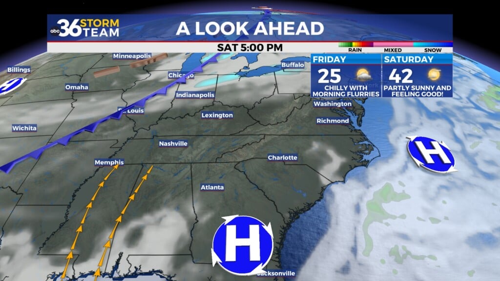
While moisture will be limited as the front moves through, a few scattered snow showers will be possible Thursday night and into Friday along with a reinforcing shot of colder air, although it will be nothing like what we have seen lately. Afternoon highs will back off a few degrees into the upper 20s to end the week on Friday but that should be manageable given all the Arctic air of late. Heading into the weekend our weather looks quiet and milder with afternoon highs jumping all the way back into the low to mid-40s Saturday. It should really feel good considering how cold it’s been lately and should be a good chance to get outside briefly to break any “cabin fever” that may have set in the last few weeks.
We are still watching the potential of a storm system developing off to our southwest late Sunday and into Monday but much of the model data is really struggling with how far north it could potentially go along with the temperature profiles associated with it. Right now it appears that we’ll see a low end chance for some rain and snow showers heading into early next week as temperatures stay into the upper 30s for afternoon highs. As we get closer to that window late this weekend we should have a better handle on how things will play out. The good news heading into early next week is that temperatures look to stay at or above average for late January so highs will be back into the low and mid-40s!
ABC 36 HOUR FORECAST
WEDNESDAY NIGHT: Scattered clouds, a cold breeze. Lows in the mid-teens.
THURSDAY: Clouds increase, a few flakes late. Highs in the low-30s.
THURSDAY NIGHT: Mostly cloudy with a few flurries. Lows in the mid-teens.
WEDNESDAY NIGHT: Scattered clouds, a cold breeze. Lows in the mid-teens.
THURSDAY: Clouds increase, a few flakes late. Highs in the low-30s.
THURSDAY NIGHT: Mostly cloudy with a few flurries. Lows in the mid-teens.


