Thawing out from the Arctic deep freeze this weekend
Temperatures will return to the 40s for highs across the region
It was a chilly finish to the week across Central and Eastern Kentucky as a reinforcing shot of colder air moved in behind a departing frontal system. After starting the day in the mid-teens, temperatures struggled to get back into the mid to upper 20s thanks to a few clouds mixed with the sunshine and a west wind pushing additional cold air into the commonwealth. Some weak energy over Southern Kentucky along with enough moisture left over help produce a few snow showers through Friday with a light dusting in a few locations before the activity settled down late. The Arctic pattern we’ve been locked in for what seems like much of January so far will finally ease up and we’ll catch a break heading into the weekend.
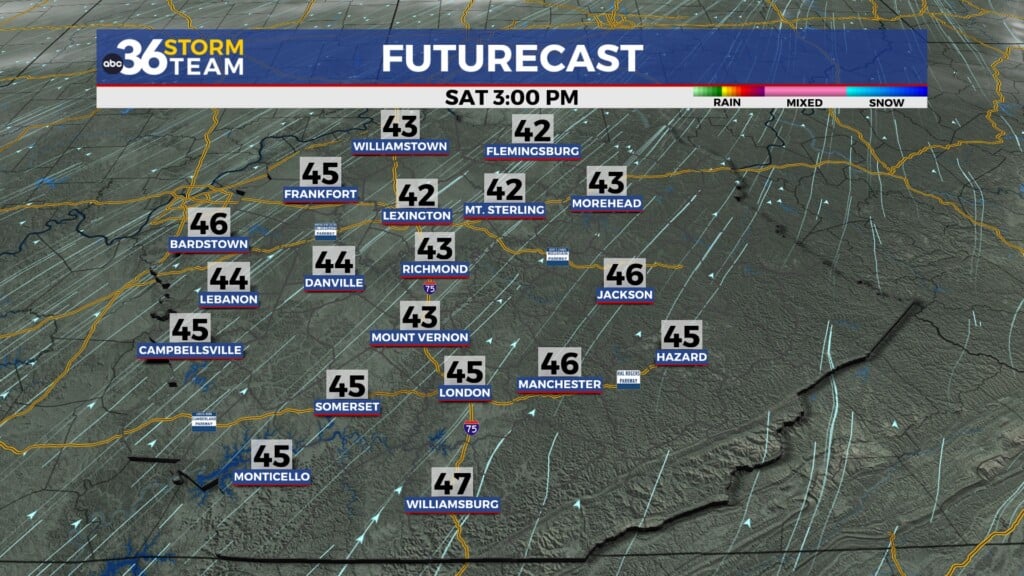
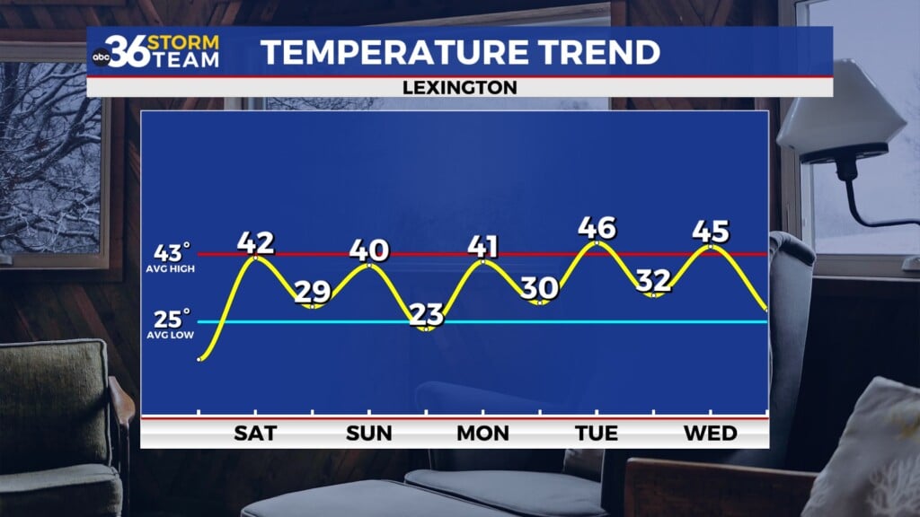
The much advertised “warm-up” will kick in Saturday as a return flow brings milder air back into the Ohio Valley. It will be a cold start to the day with temperatures in the upper teens and low 20s (haven risen slightly from the mid-teens during the overnight hours) but the combination of sunshine along with a steady south breeze will push temperatures back into the low 40s for afternoon highs. This is right around average for late January and something we haven’t seen a whole lot of lately. If you are suffering from “cabin fever” due to all the recent snow, ice and cold then Saturday will be a great day to get out and enjoy some fresh air for a change of pace.
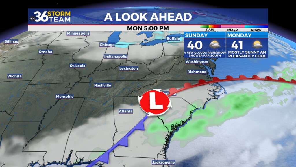
A dry cold front will drop through the region on Sunday and we aren’t expecting anything more than a few clouds out of it along with winds shifting to the west. There won’t be any big change in air mass behind the boundary so we’ll trim a few degrees off of afternoon highs to end the weekend with temperatures topping out around 40 degrees. A wave of energy sliding by to our south could bring a few clouds and maybe a rain or snow showers to areas along the Kentucky/Tennessee border Sunday night so there is that chance still but the data has been trending that activity farther south so most spots should be dry.
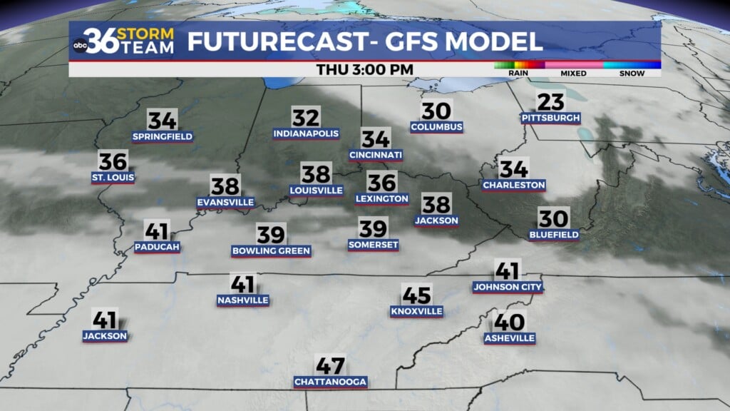
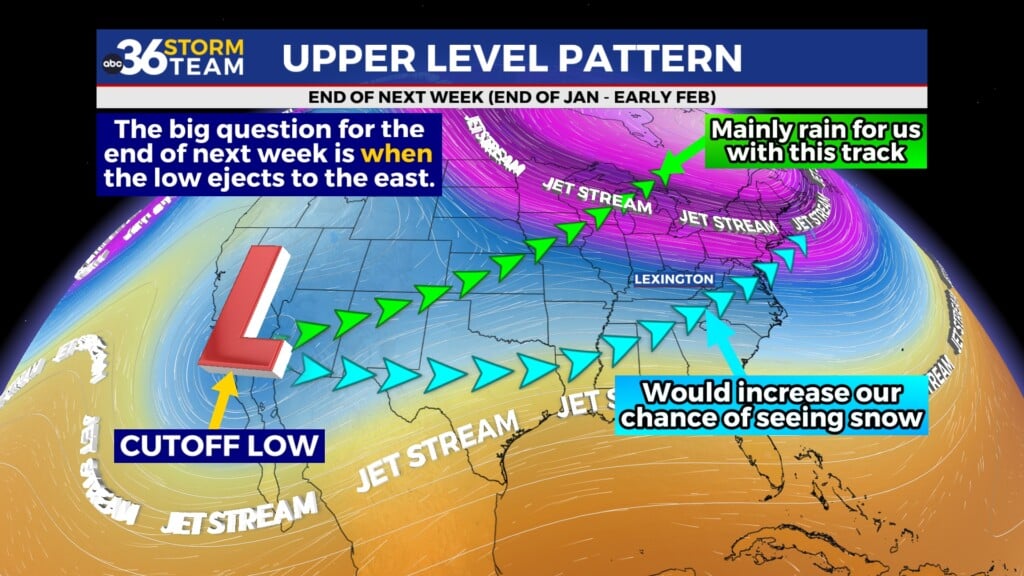
A more tranquil weather pattern will kick in early next week with dry conditions, some sunshine and afternoon highs climbing back into the low to mid-40s. The only potential hiccup down the road is whether a trough digging into the Mid-Atlantic spreads a little farther west into the Ohio Valley late next week as some of the data is showing. If that happens we could see a brief shot of chilly air around Thursday with temperatures backing down into the 30s for highs but there is still some uncertainty whether that will occur so for now we’ll keep highs in the 40s across Central and Eastern Kentucky during that window. A cut-off low over the Desert Southwest should play a part in shaping our weather by next weekend and the track of that low will be key to whether we see mainly rain or snow so stay tuned.
ABC 36 HOUR FORECAST
FRIDAY NIGHT: Mostly clear, slowly rising temperatures. Lows in the mid-teens early rising to around 20 degrees at daybreak.
SATURDAY: Mostly sunny, breezy and milder. Highs in the low-40s.
SATURDAY NIGHT: A few clouds, not as cold. Lows in the upper-20s.
FRIDAY NIGHT: Mostly clear, slowly rising temperatures. Lows in the mid-teens early rising to around 20 degrees at daybreak.
SATURDAY: Mostly sunny, breezy and milder. Highs in the low-40s.
SATURDAY NIGHT: A few clouds, not as cold. Lows in the upper-20s.
