January cold stays locked in for the mid-week
Early morning lows may run into the single digits Wednesday morning
It definitely felt like mid-January to kick things off on Tuesday with most locations starting the day in the low teens thanks to clear skies, light winds and the solid snowpack in place. The morning featured plenty of sunshine but with a fast moving clipper system dropping in from the northwest brought clouds and a few flurries to the northern and eastern part of the commonwealth later in the day. Breezy southwest winds along with the extended sunshine help push afternoon highs all the way into the mid to upper 30s but temperatures should tumble behind the departing system quickly through Tuesday evening. Be careful of a few slick spots into the overnight hours due to some re-freezing of the snowmelt potentially on some roadways.
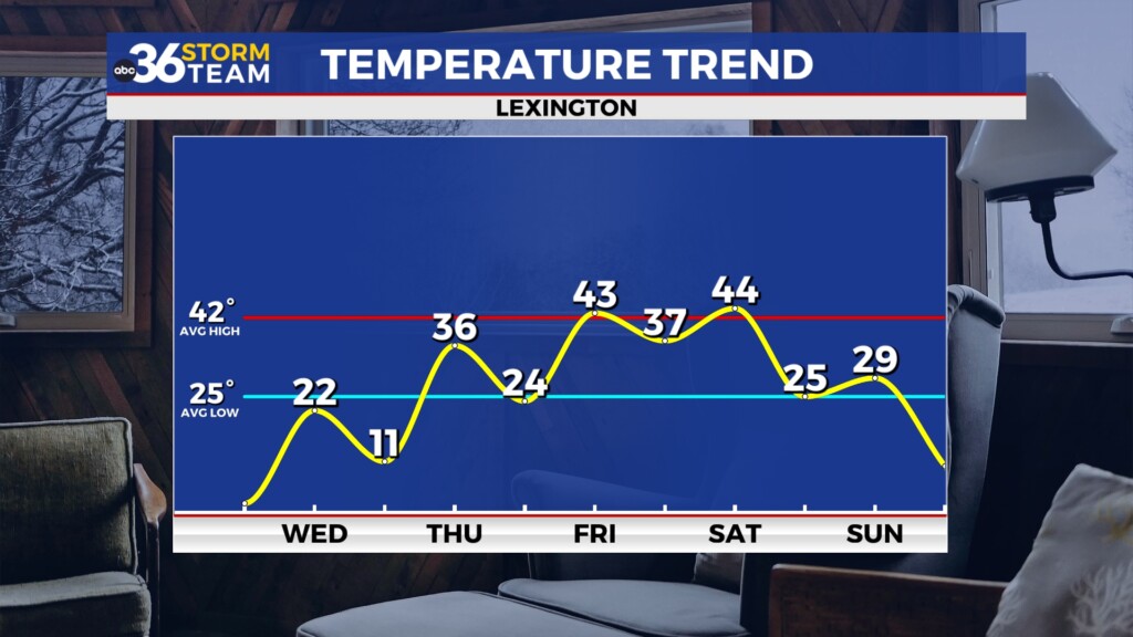
The big story into early Wednesday will be the potential for one of our coldest mornings in quite some time across the commonwealth. The combination of additional Arctic air, light winds and the stubborn snowpack in place should allow temperatures to drop down into the low single digits in many locations. A few sheltered areas could even drop below zero for a short period of time. You’ll definitely need to bundle up if you are out early on Wednesday. With Arctic high pressure overhead the afternoon should feature plenty of sunshine but unfortunately that won’t do much to help temperatures recover as afternoon highs struggle to get into the low 20s.
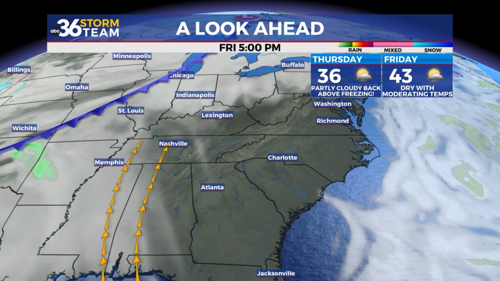
A brief shift in our weather pattern is expected late week as a bit of a return flow kicks in. Southwest winds should help push highs back into the mid-30s on Thursday before we surge into the low 40s by Friday, which is right around average for this time of the year. Our next storm system will be gearing up for the weekend but at this point it looks like much of the day Friday will remain dry with just increasing clouds expected late with a few light rain showers possible into Friday evening.
The weekend should start out wet across Central and Eastern Kentucky as a wave of energy to our southwest pushes abundant moisture northward into the Ohio Valley as a frontal boundary moves in from the northwest. It should be a chilly rain through Saturday with near steady temperatures around the 40 degree mark. The persistent rain through the day should help melt some of the snowpack down as well. Much colder air is set to return for the second half of the weekend and with some energy riding along the boundary to our east, snow showers will be possible on Sunday especially across Southern and Eastern Kentucky. We’ll have to watch this system closely for some possible accumulating snow late Sunday. Another round of Arctic air will arrive for the King holiday and beyond so we’ll stay locked into the deep freeze again heading into late January.
ABC 36 HOUR FORECAST
TUESDAY NIGHT: Clearing out, frigid temperatures. Lows ranging from 2 to 6 above.
WEDNESDAY: Mostly sunny, still cold. Highs in the mid-20s.
WEDNESDAY NIGHT: Mostly clear, very cold again. Lows in the low teens.
TUESDAY NIGHT: Clearing out, frigid temperatures. Lows ranging from 2 to 6 above.
WEDNESDAY: Mostly sunny, still cold. Highs in the mid-20s.
WEDNESDAY NIGHT: Mostly clear, very cold again. Lows in the low teens.


