More Arctic cold on the way to the commonwealth
Snow showers will be possible Tuesday as temperatures take a tumble
We finally managed to sneak above the freezing mark across Central and Eastern Kentucky to close out the weekend which allowed a lot of the accumulated ice from the winter storm a week ago to melt off the trees, power lines, etc. This “thaw” will be a brief one as another round of unseasonably cold air will settle back in the next few days. With some clouds around early Monday and a cold front moving east of the area, temperatures didn’t move very much initially before some sunshine pushed afternoon highs in the mid to upper 30s. Unfortunately readings will heads the other direction and stay below average over the next few days.
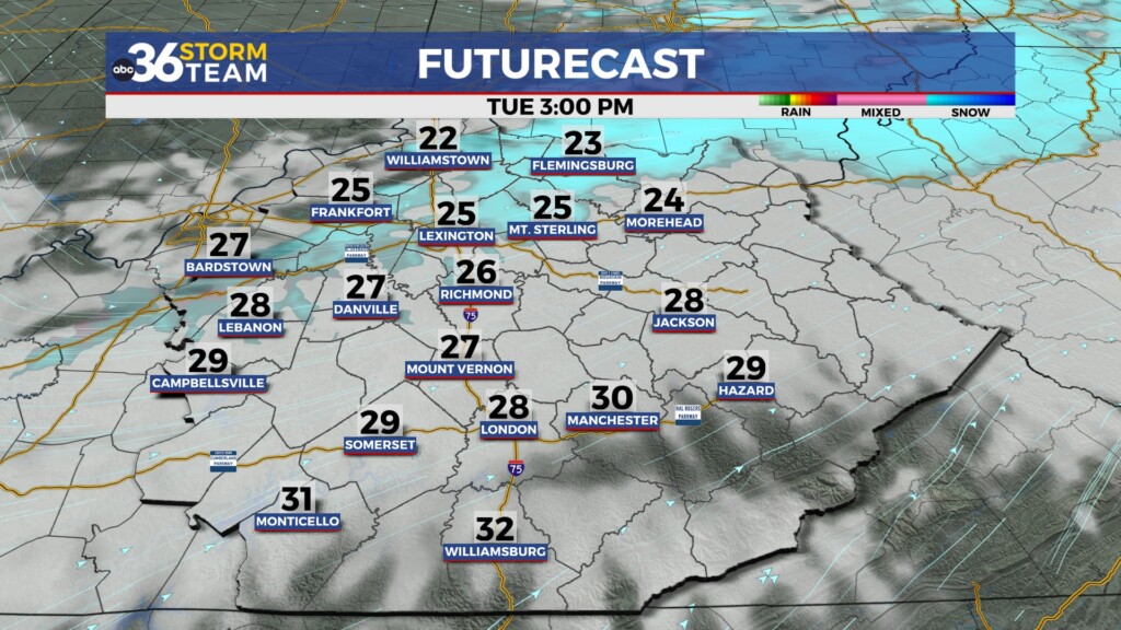
A secondary boundary will drop into the Ohio Valley on Tuesday bringing a reinforcing shot of Arctic air to the Bluegrass. While moisture will be limited with this front the air will be cold enough to squeeze out some light snow showers especially here in Central Kentucky. There is the potential to lay a light coating down on the roadways but the overall impact should be limited especially compared to what we’ve dealt with the last week or so. Afternoon highs will only reach the mid to upper 20s and with a brisk west wind in place, wind chills should drop down into the teens through the day so keep that in mind.
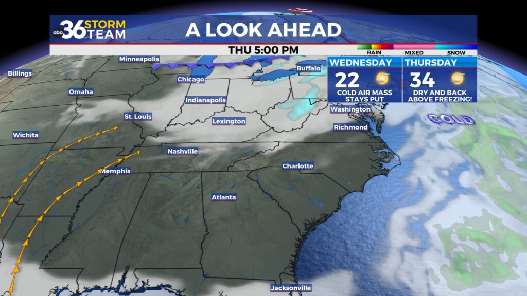
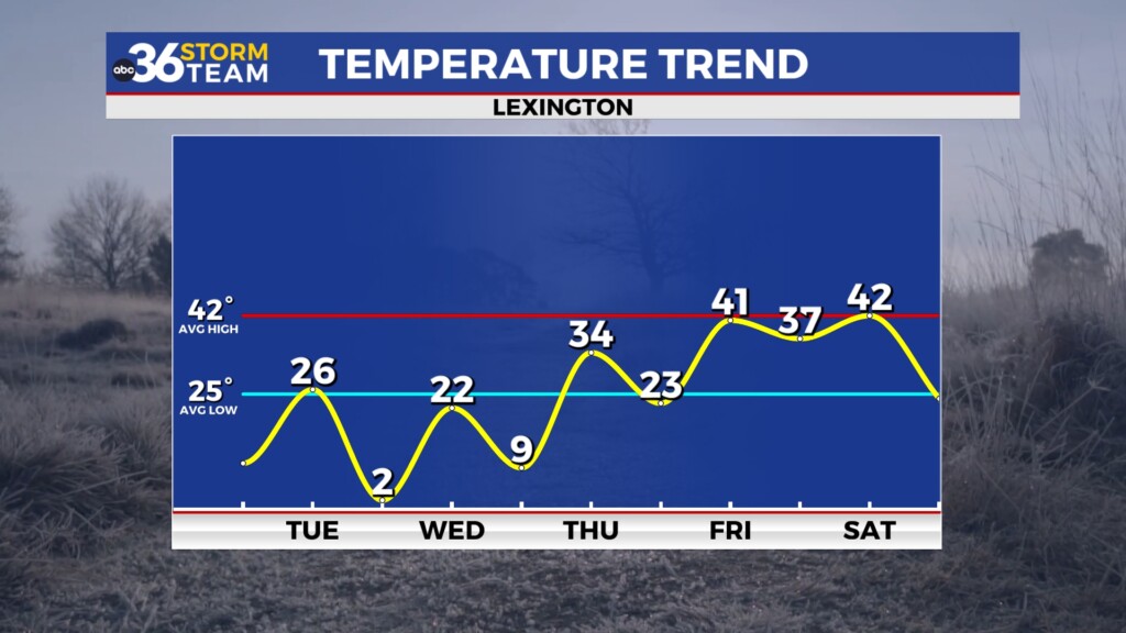
The combination of clearing skies, a lingering snowpack and a very cold air mass in place will set us up for single digit low temperatures on Wednesday morning. Even a light breeze could drop our “feel-like” temperatures below zero at times to begin the day so you’ll need to bundle up for sure. Expect plenty of sunshine during the day but it won’t help to warm things up as afternoon highs only recover into the low 20s. Luckily this Arctic air won’t hang around long as temperatures should begin to moderate pretty quickly later in the week. We’ll see another frigid start to Thursday with more single digit lows in spots before afternoon highs recover into the low 30s with that upward trend continuing toward the weekend.
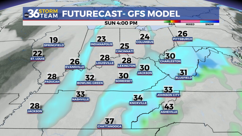
A quick pattern shift is in store for the weekend as we see a return flow from the south which will help push temperatures back closer to average for mid-January into the low 40s. A wave of energy to our southwest will feed moisture northward into the area as a frontal boundary drops in from the northwest. These two systems should work together to bring a widespread rain event to the area into Saturday. While it looks to be a chilly rain it should be in the liquid form as afternoon highs hover in the upper 30s to around 40 degrees during the daylight hours Saturday. While the data isn’t synced up totally, more cold air will pour in behind the boundary and with enough moisture hanging around, we should see a changeover to snow showers Saturday night and into Sunday. It still remains to be seen if we see enough snow to accumulate but it definitely bears watching toward the weekend. Yet another blast of Arctic air should settle in by early next week.
ABC 36 HOUR FORECAST
MONDAY NIGHT: Scattered clouds, very cold. Lows in the low teens.
TUESDAY: Breezy and cold, a few snow showers. Highs in the mid-20s.
TUESDAY NIGHT: Clearing skies and frigid. Lows in ranging 2 to 6 degrees above.
MONDAY NIGHT: Scattered clouds, very cold. Lows in the low teens.
TUESDAY: Breezy and cold, a few snow showers. Highs in the mid-20s.
TUESDAY NIGHT: Clearing skies and frigid. Lows in ranging 2 to 6 degrees above.


