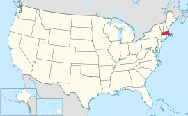
Massachusetts
Ìrísí
| Commonwealth of Massachusetts | |||||
| |||||
| Ìlàjẹ́: The Bay State | |||||
| Motto(s): Ense petit placidam sub libertate quietem (Latin) | |||||
 | |||||
| Èdè oníibiṣẹ́ | None | ||||
| Orúkọaráàlú | Bay Stater;[1] Massachusite (traditional)[2][3] | ||||
| Olúìlú (àti ìlú atóbijùlọ) |
Boston | ||||
| Largest metro area | Greater Boston | ||||
| Àlà | Ipò 44th ní U.S. | ||||
| - Total | 10,555[4] sq mi (27,336 km2) | ||||
| - Width | 183 miles (295 km) | ||||
| - Length | 113 miles (182 km) | ||||
| - % water | 25.7 | ||||
| - Latitude | 41° 14′ N to 42° 53′ N | ||||
| - Longitude | 69° 56′ W to 73° 30′ W | ||||
| Iyeèrò | Ipò 14th ní U.S. | ||||
| - Total | (2010) 6,547,629[5] | ||||
| - Density | 809.8/sq mi (312.7/km2) Ranked 3rd in the U.S. | ||||
| - Median income | $65,401 (2008) (6th) | ||||
| Elevation | |||||
| - Highest point | Mount Greylock[6][7][8] 3,489 ft (1063.4 m) | ||||
| - Mean | 500 ft (150 m) | ||||
| - Lowest point | Atlantic Ocean[7] sea level | ||||
| Admission to Union | February 6, 1788 (6th) | ||||
| Gómìnà | Deval Patrick (D) | ||||
| Ìgbákejì Gómìnà | Tim Murray (D) | ||||
| Legislature | General Court | ||||
| - Upper house | Senate | ||||
| - Lower house | House of Representatives | ||||
| U.S. Senators | John Kerry (D) Scott Brown (R) | ||||
| U.S. House delegation | 10 Democrats (list) | ||||
| Time zone | Eastern: UTC-5/-4 | ||||
| Abbreviations | MA Mass. US-MA | ||||
| Website | mass.gov | ||||
Massachusetts State Symbols
| |
|---|---|
| Animate insignia | |
| Bird | Black-capped Chickadee, Wild Turkey |
| Fish | Cod |
| Flower | Mayflower |
| Insect | Ladybug |
| Mammal | Right whale, Morgan horse, Tabby cat, Boston Terrier |
| Reptile | Garter snake |
| Tree | American Elm |
| Inanimate insignia | |
| Beverage | Cranberry Juice |
| Colors | Blue, Green, Cranberry |
| Dance | Square Dance |
| Food | Cranberry, Corn muffin, Navy bean, Boston cream pie, Chocolate chip cookie, Boston cream donut |
| Fossil | Mastodon |
| Gemstone | Rhodonite |
| Mineral | Babingtonite |
| Poem | "Blue Hills of Massachusetts" |
| Rock | Roxbury Puddingstone |
| Shell | Wrinkled Whelk |
| Ship(s) | Schooner Ernestina |
| Slogan(s) | Make It Yours, The Spirit of America |
| Soil | Paxton |
| Song(s) | All Hail to Massachusetts |
| Sport | Basketball, Baseball, Hockey, Football, Soccer |
| Route marker(s) | |
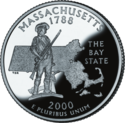
| State Quarter | |
| Released in 2000 | |
| Lists of United States state insignia | |
Massachusetts je ipinle kan ni orile-ede Amerika.

|
Àyọkà yìí tàbí apá rẹ̀ únfẹ́ àtúnṣe sí. Ẹ le fẹ̀ jù báyìí lọ tàbí kí ẹ ṣàtúnṣe rẹ̀ lọ́nà tí yíò mu kúnrẹ́rẹ́. Ẹ ran Wikipedia lọ́wọ́ láti fẹ̀ẹ́ jù báyìí lọ. |
Itokasi
[àtúnṣe | àtúnṣe àmìọ̀rọ̀]- ↑ "Massachusetts General Laws, Chapter 2, Section 35: Designation of citizens of commonwealth". The Commonwealth of Massachusetts. Archived from the original on November 23, 2008. Retrieved February 29, 2008.
- ↑ _____, page 435. Collections, Massachusetts Historical Society. MHS, Boston; 1877. Additional on-line source: Google Books.
- ↑ Jones, Thomas, page 465. History of New York During the Revolutionary War, New York Historical Society. Edward Floyd DeLancey, Ed., New York; 1879. Additional on-line source: Google Books
- ↑ Àṣìṣe ìtọ́kasí: Invalid
<ref>tag; no text was provided for refs named2000census - ↑ "2010 Census Data". United States Census Bureau. Archived from the original on October 16, 2013. Retrieved December 22, 2010.
- ↑ Àdàkọ:Cite ngs
- ↑ 7.0 7.1 "Elevations and Distances in the United States". United States Geological Survey. 2001. Archived from the original on July 22, 2012. Retrieved October 21, 2011.
- ↑ Elevation adjusted to North American Vertical Datum of 1988.


