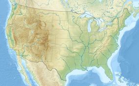
梅迪辛博-鲁特国家森林
外观
| 梅迪辛博-鲁特国家森林 | |
|---|---|
IUCN分类VI(资源管理保护区) | |
 梅迪辛博国家森林 | |
| 位置 | |
| 最近城市 | 怀俄明州夏延 |
| 坐标 | 41°35′N 106°13′W / 41.583°N 106.217°W |
| 面积 | 2,222,313英畝(8,993.38平方公里)[1] |
| 建立 | 1902年5月22日[2] |
| 管理机构 | 美国国家森林局 |
| 网站 | Medicine Bow – Routt National Forest |
梅迪辛博-鲁特国家森林(英語:Medicine Bow – Routt National Forest)是美国国家森林局管控的一座国家森林,面积超过2,222,313英畝(8,993.38平方公里)[3],位于怀俄明州和科羅拉多州。森林前身是三个不同的区域:梅迪辛博国家森林、鲁特国家森林和雷霆盆地国家草原,后因位置相近、环境类似而合并为一处森林,联合管控。
参考资料
[编辑]- ^ Land Areas of the National Forest System (PDF). U.S. Forest Service. 2012-01 [2012-06-30]. (原始内容存档 (PDF)于2013-01-16).
- ^ The National Forests of the United States (PDF). ForestHistory.org. [2012-07-30]. (原始内容 (PDF)存档于2013-02-12).
- ^ Table 6 - NFS Acreage by State, Congressional District and County (页面存档备份,存于互联网档案馆) - 美国国家森林局 - 2007-09-30
| 这是一篇與美国地理相關的小作品。您可以通过编辑或修订扩充其内容。 |
