Excessive Rainfall Discussion
NWS Weather Prediction Center College Park MD
734 PM EST Sun Dec 22 2024
Day 1
Valid 01Z Mon Dec 23 2024 - 12Z Mon Dec 23 2024
The probability of rainfall exceeding flash flood guidance is less
than 5 percent.
Chenard
Day 1 threat area:
www.wpc.ncep.noaa.gov/qpf/94epoints.txt
Excessive Rainfall Discussion
NWS Weather Prediction Center College Park MD
258 AM EST Mon Dec 23 2024
Day 1
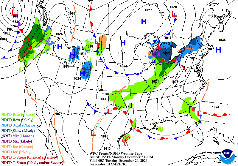
Valid 12Z Mon Dec 23 2024 - 12Z Tue Dec 24 2024
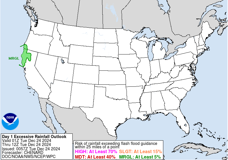
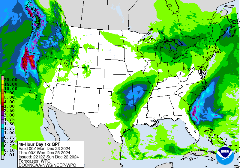
...THERE IS A MARGINAL RISK OF EXCESSIVE RAINFALL FOR PORTIONS OF
NORTHERN CALIFORNIA AND SOUTHWEST OREGON...
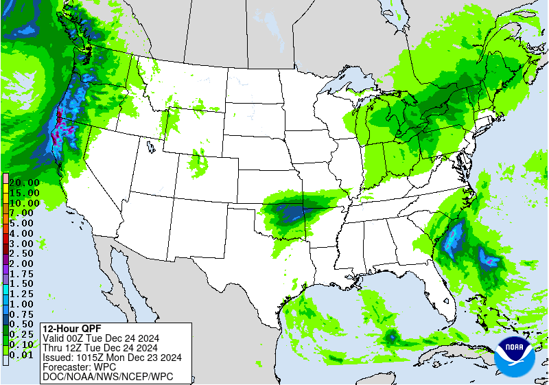
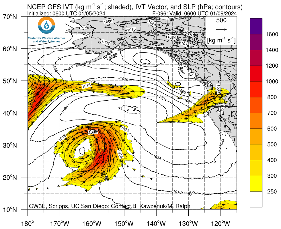
The next atmospheric river will make headway into southwest OR and
northwest CA coastal plain with a protrusion of elevated IVT inland
as we work the back end of the period. Consistency among all major
deterministic, both global and hi-res indicate a widespread area of
2-4" with locally as high as 5.5" in-of the impacted areas, mainly
north of Santa Rosa up into southwest OR. Latest HREF probs for >3"
are very high (80+%) across areas like the King and Siskiyou Ranges
along with the Foothills of Mount Shasta. Despite the elevation, a
strong warm nose with this event will send snow levels spiking
upwards with the base pushing close to 8000ft MSL for the
rain/snow delineation point. This will create a better heavy
rain threat even away from the coast with areas inland also
maintaining a threat for localized flash flood concerns, especially
as we move into early Tuesday morning. The heaviest rainfall will
likely be within those coastal ranges which are some of the harder
areas to flood, so that will help limit the extensive flash flood
prospects we see with some events. The progressive nature of the AR
regime will also aid in the anticipated impacts, however the threat
is still within the low to medium end of the MRGL risk threshold
leading to a continuance of the MRGL from the previous forecast
issuance. The area(s) with the greatest potential are those that
are still dealing with burn scar aftermath with very sensitive
runoff capabilities. Those are included within the MRGL risk,
especially across northern CA.
Kleebauer
Day 1 threat area:
www.wpc.ncep.noaa.gov/qpf/94epoints.txt
Excessive Rainfall Discussion
NWS Weather Prediction Center College Park MD
258 AM EST Mon Dec 23 2024
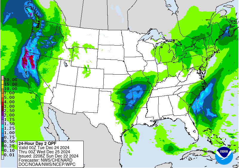
Day 2
Valid 12Z Tue Dec 24 2024 - 12Z Wed Dec 25 2024
...THERE IS A MARGINAL RISK OF EXCESSIVE RAINFALL FOR THE NORTHERN
SIERRA FOOTHILLS AND EAST TEXAS INTO THE LOWER MISSISSIPPI VALLEY...
..Sierra Foothills..
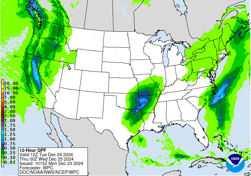
Atmospheric river from previous period will bleed into the D2 time
frame with the primary shortwave trough quickly propagating inland
with increased forcing upon arrival into the Northern and Central
Sierra, less so for areas back into the coast due to negative
vorticity advection. Locally enhanced rainfall will be plausible
the initial portion of the period with the heaviest likely aligned
along those Foothill regions of the Northern Sierra, mainly within
elevations below 8000ft, although snow levels will fall below
7000ft towards the end of the more significant precipitation time
frame late Tuesday morning. Additional totals of 1-2" are possible
within a 6-10 hour window prior to the precip ending leading to a
low-end potential for flash flood concerns just outside the Valley
that extends from Redding down to Sacramento. Higher runoff
capabilities due to terrain orientation and soil moisture anomalies
running closer to normal will present some potential for flood
concerns despite this being an event that doesn't maintain a more
prolonged precipitation signature.
The previously inherited MRGL risk was generally maintained,
however some of the risk area was cut out due to provide a gradient
between the Sierra locations that will trend to more winter
precipitation and the areas that will remain liquid through much
of, if not the entire duration of the event.
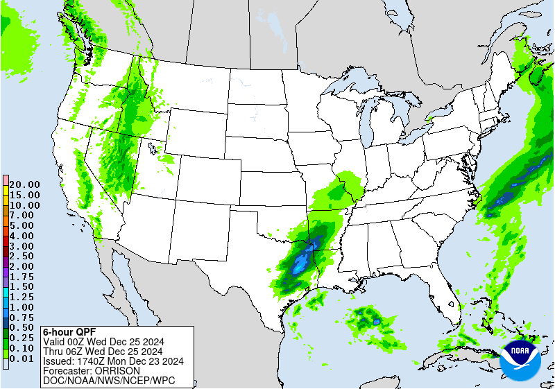
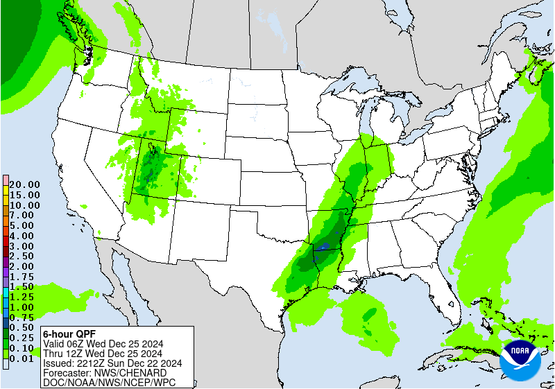
..Arklatex and Lower Mississippi Valley..
Surface ridge over the eastern CONUS will slowly drift further to
the northeast allowing for a more broad return flow regime to
affect areas across the Western Gulf into the Lower Mississippi
Valley. A steady flux of higher theta_E's will begin moving
northward out of the Western Gulf, carrying as far north as the Red
River before stabilizing as we reach into OK. Aloft, a digging
mid- level shortwave will exit the Central Rockies with sights on
the Southern Plains leading to enhanced left exit region dynamics
and surface cyclogenesis in-of the Red River Valley with a cold
front extending from the base into TX and a small warm front
lifting northward around the Arklatex. The classic mid-latitude
cyclogenesis will create a sector of modest destabilization with
the primary axis aligned from southwest to northeast across east TX
up through the Arklatex, eventually extending northward into AR
and southern MO. The current indications are the best organized
convective schemes will be situated around the small warm sector
along and ahead of the approaching cold front with relative
buoyancy and increasing upstream shear allowing for scattered
convection to develop late Tuesday afternoon through the evening.
As of this time, the deep layer moisture pattern is still
relatively meager compared to some of the more impactful events
that occur in this area of the country, however there is enough
instability and PWAT anomalies creeping between 1-1.5 deviations
above normal to constitute some isolated flash flood concerns,
mainly within those stronger cores. SPC D2 risk includes a targeted
Marginal Risk for severe weather, overlapping the inherited MRGL
risk ERO for the period. Areal rainfall averages will be between
0.5-1" across east TX and 0.75-1.5" across AR, but there is a
growing consensus among the CAMs to have scattered instances of a
quick 2-3" of rainfall within the best convective environment
during the pattern evolution with a 5-10% risk of >3" within the
tail end of the 00z HREF neighborhood probs. This threat is likely
still within the lower end of the MRGL risk threshold, but the
convective premise was enough to maintain general continuity from
the previous issuance.
Kleebauer
Day 2 threat area:
www.wpc.ncep.noaa.gov/qpf/98epoints.txt
Excessive Rainfall Discussion
NWS Weather Prediction Center College Park MD
258 AM EST Mon Dec 23 2024
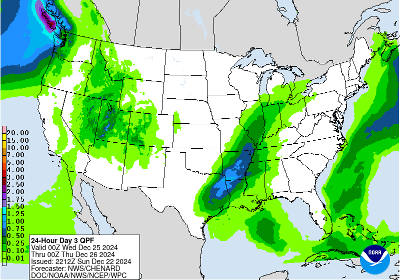
Day 3
Valid 12Z Wed Dec 25 2024 - 12Z Thu Dec 26 2024
...THERE IS A MARGINAL RISK OF EXCESSIVE RAINFALL FOR COASTAL
WASHINGTON AND OREGON...
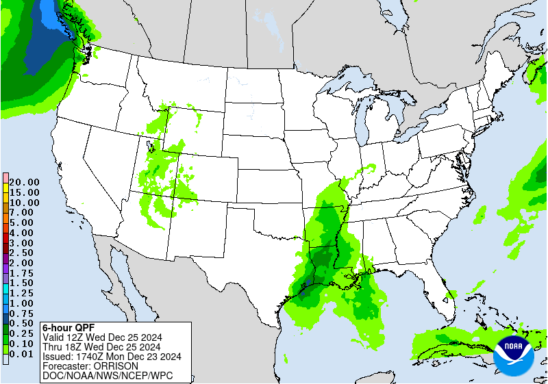
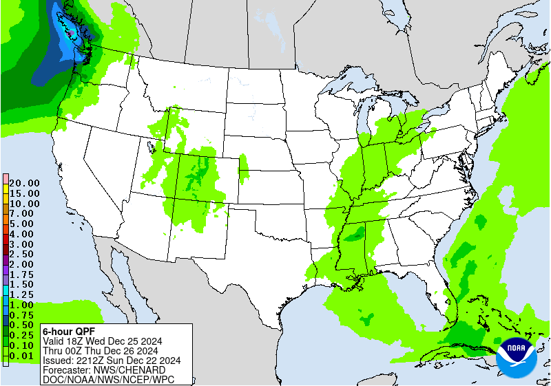
Another atmospheric river surging off the Pacific will make an
appearance into the Pacific Northwest by Wednesday afternoon
through the end of the D3 cycle. Model guidance is keen on a surge
of moisture represented by fairly elevated IVT signatures on the
order of 600-800 kg/ms within the global ensemble blend. There is
some discrepancy between one of the main deterministic (GFS) and
the other global members carrying more of a 25th percentile outcome
in total precip due to a less robust IVT pulse comparatively. When
assessing the ensemble means from the GEFS compared to the
deterministic, the ensemble sways more in favor the scenario of
greater magnitudes into the IVT channel leading to a more
pronounced atmospheric river regime. This trend leaned more into
maintaining continuity in the inherited MRGL risk across the PAC
NW, although a few changes were made in the proposal.
The first change was to scale back on the eastern extension of the
MRGL risk due to considerably less deep layer moisture advecting
inland at this juncture for the D3 time frame. FFG indices are
still pretty high all the way towards the windward side of the
Cascades, so the prospects for FFG exceedance were pretty low and
generally fall below the 5% threshold criteria. The second change
was to cut out the higher elevations in the Olympic Peninsula due
to the primary ptype trending towards snow with more emphasis on
rainfall closer to the coast and below 4000ft MSL. The risk area
still encompasses the lower elevations surrounding the Olympics and
channels into the Olympic National Forest on the southern flank of
the Peninsula. Anticipate totals of 2-4" with locally as high as 5"
in the risk area extending from coastal southwest OR up through the
Olympic coast of WA.
Kleebauer
Day 3 threat area:
www.wpc.ncep.noaa.gov/qpf/99epoints.txt
Extended Forecast Discussion
NWS Weather Prediction Center College Park MD
203 AM EST Mon Dec 23 2024
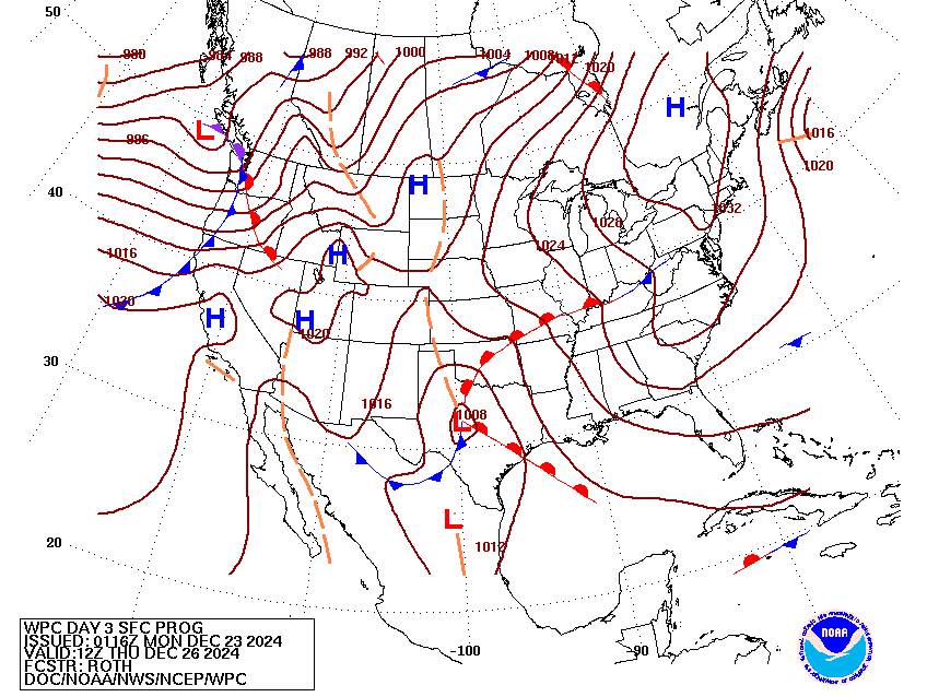
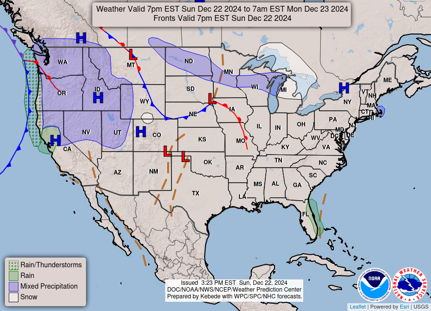
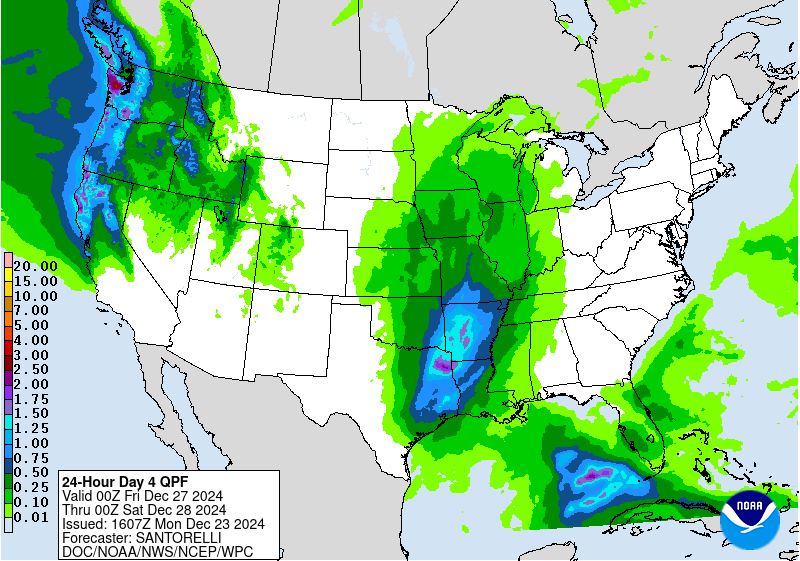
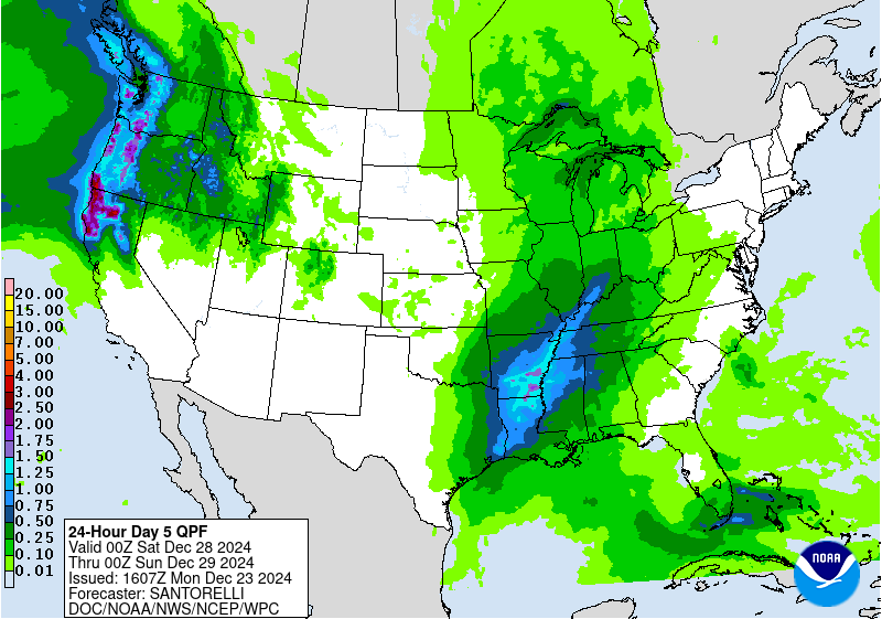
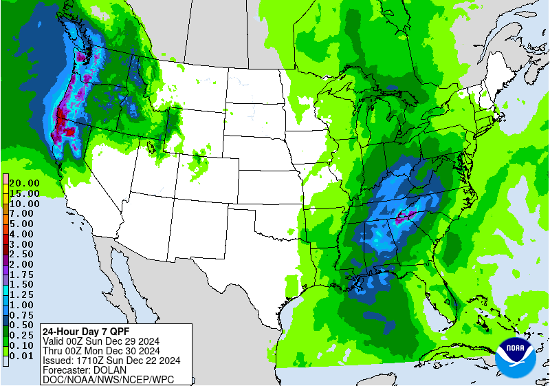
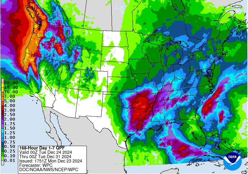
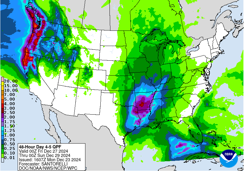
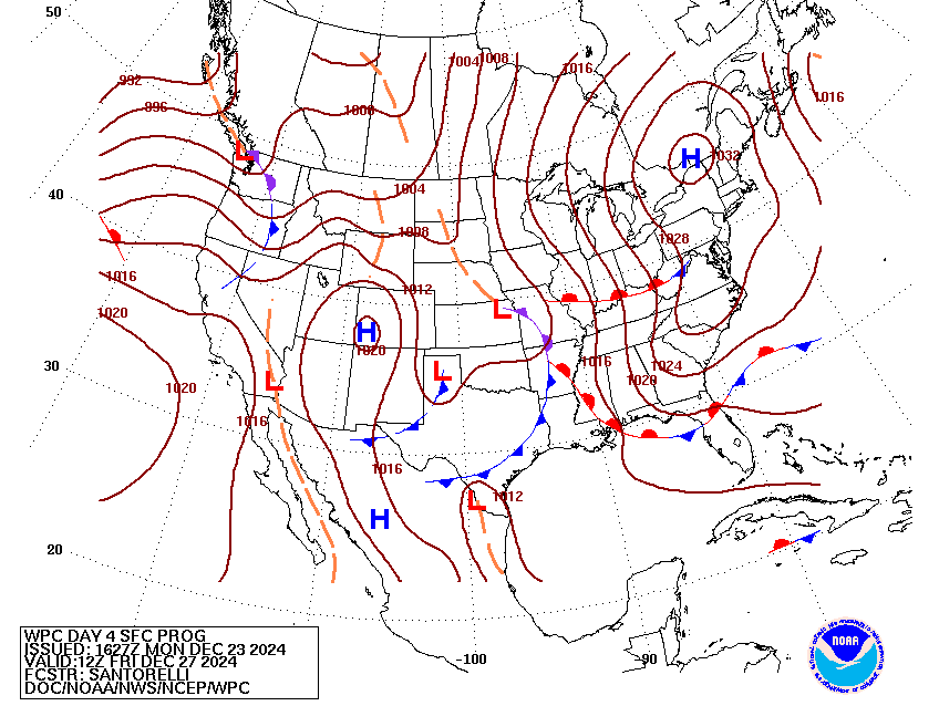
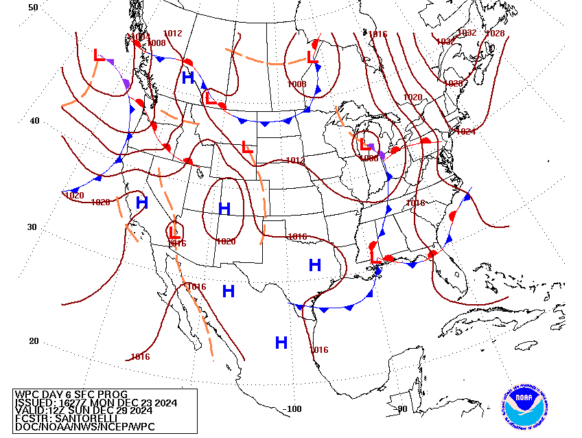
Multiple rounds of moderate to heavy rainfall are expected to
impact the West Coast later this week as multiple frontal systems
approach the coast south of lows headed for southwest Canada, with
the signal for heavy rainfall becoming stronger by the day between
Thursday and next Sunday and eventually concentrating near the
California/Oregon border. Flooding will be possible, especially
where burn scars exist and possibly near the steep terrain of the
Olympics and coastal mountain ranges and into the foothills of the
Cascades. A Marginal Risk of Excessive Rainfall is in effect for
coastal Washington, Oregon, and northern California on Thursday and
Friday.
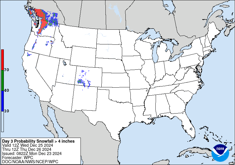
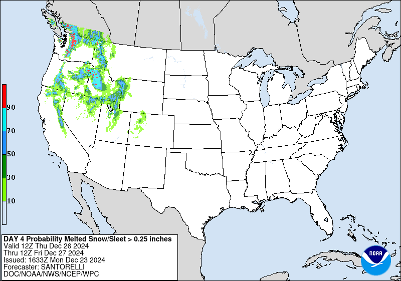
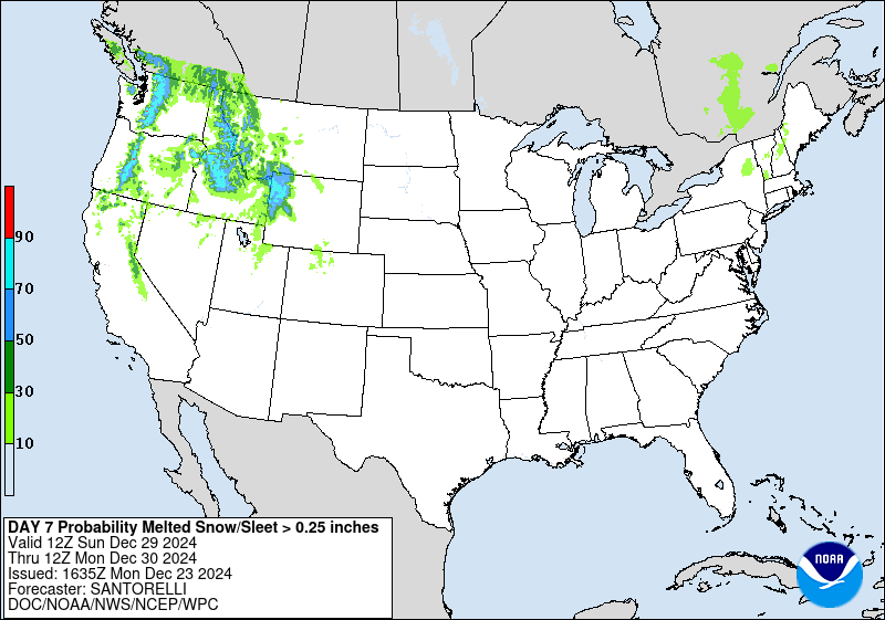
Moisture spreading inland in the West will likely produce heavy
snow over the higher/highest terrain of the Cascades and Rocky
mountains, and portions of the Sierra Nevada. Heavy snow will
focus over the Northwest on Christmas and expand through the
Intermountain West/Rockies later this week.
Downstream, multiple frontal systems will bring rain and
thunderstorm chances to the Plains, Mississippi Valley, and
Southeast. Southerly flow will bring moisture up from the Gulf of
Mexico into the Ark-La-Tex region where multiple rounds of rain are
expected. A Maringal Risk of Excessive Rainfall exists for that
area on Thursday/Thursday night.
Widespread above normal/mild temperatures by late December
standards are expected across the Central U.S. for the entire
forecast period, ranging from 5 to 20 degrees above average.
Relative mildness spreads into the East with time. The greatest
positive anomalies are likely across portions of the Upper Midwest
and extending into the Ohio Valley by Saturday. Readings closer to
climatology are expected near the West Coast.
Roth/Dolan
