Jump to content

110th meridian west

From Wikipedia, the free encyclopedia
Line across the Earth
110°
110th meridian west
In Canada, the 110th meridian west defines part of the border between the Northwest Territories and Nunavut, and it approximately defines the border between Alberta and Saskatchewan.

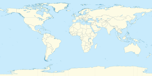
The meridian 110° west of Greenwich is a line of longitude that extends from the North Pole across the Arctic Ocean, North America, the Pacific Ocean, the Southern Ocean, and Antarctica to the South Pole.

The 110th meridian west forms a great circle with the 70th meridian east.

In Canada, the meridian forms the boundary between Nunavut and the Northwest Territories north of the parallel 70° north.[1] Originally 110°W was intended as the Fourth Meridian for the Dominion Land Survey, but because of the imperfect surveying methods of the time, the meridian was placed a few hundred metres west of this longitude. The Fourth Meridian has been the entire boundary between Alberta and Saskatchewan since 1905.

In the United States, the meridian formed the western border of the historic and extralegal Territory of Jefferson.[2]

From pole to pole

[edit]

Starting at the North Pole and heading south to the South Pole, the 110th meridian west passes through:
Co-ordinates Country, territory or sea Notes
90°0′N 110°0′W / 90.000°N 110.000°W / 90.000; -110.000 (Arctic Ocean) Arctic Ocean
78°41′N 110°0′W / 78.683°N 110.000°W / 78.683; -110.000 (Canada) Canada Northwest Territories / Nunavut border — Borden Island
78°19′N 110°0′W / 78.317°N 110.000°W / 78.317; -110.000 (Wilkins Strait) Wilkins Strait
78°7′N 110°0′W / 78.117°N 110.000°W / 78.117; -110.000 (Canada) Canada Northwest Territories / Nunavut border — Mackenzie King Island
77°55′N 110°0′W / 77.917°N 110.000°W / 77.917; -110.000 Unnamed waterbody
76°28′N 110°0′W / 76.467°N 110.000°W / 76.467; -110.000 (Canada) Canada Northwest Territories / Nunavut border — Melville Island
76°14′N 110°0′W / 76.233°N 110.000°W / 76.233; -110.000 (Eldridge Bay) Eldridge Bay
75°54′N 110°0′W / 75.900°N 110.000°W / 75.900; -110.000 (Canada) Canada Northwest Territories / Nunavut border — Melville Island (for about 2 km)
75°53′N 110°0′W / 75.883°N 110.000°W / 75.883; -110.000 (Sabine Bay) Sabine Bay
75°33′N 110°0′W / 75.550°N 110.000°W / 75.550; -110.000 (Canada) Canada Northwest Territories / Nunavut border — Melville Island
74°50′N 110°0′W / 74.833°N 110.000°W / 74.833; -110.000 (Parry Channel) Parry Channel Viscount Melville Sound
72°59′N 110°0′W / 72.983°N 110.000°W / 72.983; -110.000 (Canada) Canada Northwest Territories / Nunavut border — Victoria Island
Nunavut — from 70°0′N 110°0′W / 70.000°N 110.000°W / 70.000; -110.000 (Nunavut) on Victoria Island
68°37′N 110°0′W / 68.617°N 110.000°W / 68.617; -110.000 (Coronation Gulf) Coronation Gulf
68°6′N 110°0′W / 68.100°N 110.000°W / 68.100; -110.000 (Canada) Canada NunavutJameson Islands and the mainland
Northwest Territories — from 65°10′N 110°0′W / 65.167°N 110.000°W / 65.167; -110.000 (Northwest Territories), passing through the Great Slave Lake
Saskatchewan — from 60°0′N 110°0′W / 60.000°N 110.000°W / 60.000; -110.000 (Saskatchewan), passing through Lake Athabasca, around 400m east of the Alberta border
49°0′N 110°0′W / 49.000°N 110.000°W / 49.000; -110.000 (United States) United States Montana
Wyoming — from 45°1′N 110°0′W / 45.017°N 110.000°W / 45.017; -110.000 (Wyoming)
Utah — from 41°1′N 110°0′W / 41.017°N 110.000°W / 41.017; -110.000 (Utah)
Arizona — from 37°0′N 110°0′W / 37.000°N 110.000°W / 37.000; -110.000 (Arizona)
31°20′N 110°0′W / 31.333°N 110.000°W / 31.333; -110.000 (Mexico) Mexico Sonora — passing just west of Ciudad Obregón at 27°29′N 109°56′W / 27.483°N 109.933°W / 27.483; -109.933 (Ciudad Obregón)
27°4′N 110°0′W / 27.067°N 110.000°W / 27.067; -110.000 (Gulf of California) Gulf of California
24°8′N 110°0′W / 24.133°N 110.000°W / 24.133; -110.000 (Mexico) Mexico Baja California Sur
22°53′N 110°0′W / 22.883°N 110.000°W / 22.883; -110.000 (Pacific Ocean) Pacific Ocean
60°0′S 110°0′W / 60.000°S 110.000°W / -60.000; -110.000 (Southern Ocean) Southern Ocean
74°27′S 110°0′W / 74.450°S 110.000°W / -74.450; -110.000 (Antarctica) Antarctica Unclaimed territory — passing through the Walgreen Coast of Marie Byrd Land

See also

[edit]

References

[edit]
pFad - Phonifier reborn

Pfad - The Proxy pFad of © 2024 Garber Painting. All rights reserved.

Note: This service is not intended for secure transactions such as banking, social media, email, or purchasing. Use at your own risk. We assume no liability whatsoever for broken pages.


Alternative Proxies:

Alternative Proxy

pFad Proxy

pFad v3 Proxy

pFad v4 Proxy