Jump to content

60th meridian west

From Wikipedia, the free encyclopedia
Line across the Earth
60°
60th meridian west

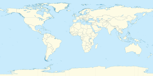
The meridian 60° west of Greenwich is a line of longitude that extends from the North Pole across the Arctic Ocean, Greenland, North America, the Atlantic Ocean, South America, the Southern Ocean, and Antarctica to the South Pole.

The mean solar time of this meridian is the base for the Atlantic Time Zone (UTC-4 during standard time).

The 60th meridian west forms a great circle with the 120th meridian east.

From Pole to Pole

[edit]

Starting at the North Pole and heading south to the South Pole, the 60th meridian west passes through:
Co-ordinates Country, territory or sea Notes
90°0′N 60°0′W / 90.000°N 60.000°W / 90.000; -60.000 (Arctic Ocean) Arctic Ocean
83°28′N 60°0′W / 83.467°N 60.000°W / 83.467; -60.000 (Lincoln Sea) Lincoln Sea
81°56′N 60°0′W / 81.933°N 60.000°W / 81.933; -60.000 (Greenland)  Greenland Hall Land
75°56′N 60°0′W / 75.933°N 60.000°W / 75.933; -60.000 (Baffin Bay) Baffin Bay
70°0′N 60°0′W / 70.000°N 60.000°W / 70.000; -60.000 (Davis Strait) Davis Strait
60°0′N 60°0′W / 60.000°N 60.000°W / 60.000; -60.000 (Atlantic Ocean) Atlantic Ocean Labrador Sea
55°24′N 60°0′W / 55.400°N 60.000°W / 55.400; -60.000 (Canada)  Canada Newfoundland and LabradorLabrador
Quebec — from 52°0′N 60°0′W / 52.000°N 60.000°W / 52.000; -60.000 (Quebec)
50°14′N 60°0′W / 50.233°N 60.000°W / 50.233; -60.000 (Gulf of Saint Lawrence) Gulf of Saint Lawrence Passing just east of St. Paul Island, Nova Scotia,  Canada (at 47°13′N 60°8′W / 47.217°N 60.133°W / 47.217; -60.133 (St. Paul Island))
47°14′N 60°0′W / 47.233°N 60.000°W / 47.233; -60.000 (Cabot Strait) Cabot Strait
46°13′N 60°0′W / 46.217°N 60.000°W / 46.217; -60.000 (Canada)  Canada Nova ScotiaCape Breton Island
45°53′N 60°0′W / 45.883°N 60.000°W / 45.883; -60.000 (Atlantic Ocean) Atlantic Ocean
43°57′N 60°0′W / 43.950°N 60.000°W / 43.950; -60.000 (Canada)  Canada Nova ScotiaSable Island
43°56′N 60°0′W / 43.933°N 60.000°W / 43.933; -60.000 (Atlantic Ocean) Atlantic Ocean
8°33′N 60°0′W / 8.550°N 60.000°W / 8.550; -60.000 (Venezuela)  Venezuela
8°6′N 60°0′W / 8.100°N 60.000°W / 8.100; -60.000 (Guyana)  Guyana Territory claimed by  Venezuela
5°5′N 60°0′W / 5.083°N 60.000°W / 5.083; -60.000 (Brazil)  Brazil Roraima — for about 18 km
4°55′N 60°0′W / 4.917°N 60.000°W / 4.917; -60.000 (Guyana)  Guyana Territory claimed by  Venezuela
4°30′N 60°0′W / 4.500°N 60.000°W / 4.500; -60.000 (Brazil)  Brazil Roraima
Amazonas — from 0°14′N 60°0′W / 0.233°N 60.000°W / 0.233; -60.000 (Amazonas), passing just east of Manaus at 3°6′S 60°1′W / 3.100°S 60.017°W / -3.100; -60.017 (Manaus)
Mato Grosso — from 8°46′S 60°0′W / 8.767°S 60.000°W / -8.767; -60.000 (Mato Grosso)
Rondônia — from 11°8′S 60°0′W / 11.133°S 60.000°W / -11.133; -60.000 (Rondônia)
Mato Grosso — from 11°28′S 60°0′W / 11.467°S 60.000°W / -11.467; -60.000 (Mato Grosso)
Rondônia — from 11°50′S 60°0′W / 11.833°S 60.000°W / -11.833; -60.000 (Rondônia)
Mato Grosso — from 12°41′S 60°0′W / 12.683°S 60.000°W / -12.683; -60.000 (Mato Grosso)
16°16′S 60°0′W / 16.267°S 60.000°W / -16.267; -60.000 (Bolivia)  Bolivia
19°18′S 60°0′W / 19.300°S 60.000°W / -19.300; -60.000 (Paraguay)  Paraguay
24°2′S 60°0′W / 24.033°S 60.000°W / -24.033; -60.000 (Argentina)  Argentina
38°51′S 60°0′W / 38.850°S 60.000°W / -38.850; -60.000 (Atlantic Ocean) Atlantic Ocean
51°18′S 60°0′W / 51.300°S 60.000°W / -51.300; -60.000 (Falkland Islands)  Falkland Islands Islands of Keppel and West Falkland — claimed by  Argentina
52°0′S 60°0′W / 52.000°S 60.000°W / -52.000; -60.000 (Atlantic Ocean) Atlantic Ocean
60°0′S 60°0′W / 60.000°S 60.000°W / -60.000; -60.000 (Southern Ocean) Southern Ocean
62°27′S 60°0′W / 62.450°S 60.000°W / -62.450; -60.000 (South Shetland Islands) South Shetland Islands Greenwich Island and Livingston Islandclaimed by  Argentina,  Chile and  United Kingdom
62°40′S 60°0′W / 62.667°S 60.000°W / -62.667; -60.000 (Southern Ocean) Southern Ocean
63°51′S 60°0′W / 63.850°S 60.000°W / -63.850; -60.000 (Antarctica) Antarctica Antarctic Peninsulaclaimed by  Argentina,  Chile and  United Kingdom
65°50′S 60°0′W / 65.833°S 60.000°W / -65.833; -60.000 (Southern Ocean) Southern Ocean Weddell Sea
68°5′S 60°0′W / 68.083°S 60.000°W / -68.083; -60.000 (Antarctica) Antarctica Territory claimed by  Argentina,  Chile and  United Kingdom
69°1′S 60°0′W / 69.017°S 60.000°W / -69.017; -60.000 (Southern Ocean) Southern Ocean Weddell Sea
72°49′S 60°0′W / 72.817°S 60.000°W / -72.817; -60.000 (Antarctica) Antarctica Territory claimed by  Argentina,  Chile and  United Kingdom
73°17′S 60°0′W / 73.283°S 60.000°W / -73.283; -60.000 (Southern Ocean) Southern Ocean Weddell Sea
75°19′S 60°0′W / 75.317°S 60.000°W / -75.317; -60.000 (Antarctica) Antarctica Territory claimed by  Argentina,  Chile and  United Kingdom

See also

[edit]

References

[edit]
pFad - Phonifier reborn

Pfad - The Proxy pFad of © 2024 Garber Painting. All rights reserved.

Note: This service is not intended for secure transactions such as banking, social media, email, or purchasing. Use at your own risk. We assume no liability whatsoever for broken pages.


Alternative Proxies:

Alternative Proxy

pFad Proxy

pFad v3 Proxy

pFad v4 Proxy