Rushford Municipal Airport
Appearance
Rushford Municipal Airport | |||||||||||
|---|---|---|---|---|---|---|---|---|---|---|---|
 | |||||||||||
| Summary | |||||||||||
| Airport type | Public | ||||||||||
| Owner | City of Rushford | ||||||||||
| Serves | Rushford, Minnesota | ||||||||||
| Elevation AMSL | 1,211 ft / 369.1 m | ||||||||||
| Coordinates | 43°48′56.9700″N 091°49′48.3420″W / 43.815825000°N 91.830095000°W | ||||||||||
| Map | |||||||||||
 | |||||||||||
| Runways | |||||||||||
| |||||||||||
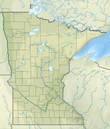
Rushford Municipal Airport (FAA LID: 55Y) also known as Robert W. Bunke Field is a city-owned public-use airport located three miles west of the city of Rushford, Minnesota in Fillmore County.[1]
Facilities and aircraft
[edit]Rushford Airport contains one runway designated 16/34 with a 3,200 x 60 ft (975 x 18 m) asphalt surface.[2] For the 12 months ending April 30, 2019, the airport had 2,000 aircraft operations, an average of 5.48 per day: 60% being local-general aviation and 40% transient general aviation. The airport housed 2 single-engine airplanes.[3]
See also
[edit]References
[edit]- ^ "FAA Information about Rushford Municipal Airport (55Y)". www.airport-data.com. Retrieved 2023-07-08.
- ^ "AirNav: 55Y - Rushford Municipal Airport/Robert W Bunke Field". www.airnav.com. Retrieved 2023-07-08.
- ^ "Rushford Municipal/Robert W Bunke Field Airport - 55Y - Airport Guide". AirportGuide. Retrieved 2023-07-08.

