Winona Municipal Airport
Appearance
This article relies largely or entirely on a single source. (April 2019) |
Winona Municipal Airport Max Conrad Field | |||||||||||
|---|---|---|---|---|---|---|---|---|---|---|---|
 | |||||||||||
| Summary | |||||||||||
| Airport type | Public | ||||||||||
| Operator | City of Winona | ||||||||||
| Location | Winona, Minnesota | ||||||||||
| Elevation AMSL | 656 ft / 200 m | ||||||||||
| Coordinates | 44°04′38″N 91°42′30″W / 44.07722°N 91.70833°W | ||||||||||
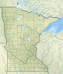
| Map | |||||||||||
 | |||||||||||
| Runways | |||||||||||
| |||||||||||
| Statistics | |||||||||||
| |||||||||||
Winona Municipal Airport (IATA: ONA, ICAO: KONA, FAA LID: ONA) (Max Conrad Field) is located three miles northwest of Winona, Minnesota and next to Goodview on the Mississippi River, in Winona County, Minnesota. It has no scheduled airline flights.
Facilities
[edit]The airport covers 575 acres (233 ha) at an elevation of 656 feet (200 m). It has one asphalt runway: 12/30 is 5,679 by 100 feet (1,731 x 30 m).[1]
For the year ending July 31, 2019 the airport had 10,450 aircraft operations, an average of 29 per day: 92% general aviation, 8% air taxi and less than 1% military. In December 2021, there were 30 aircraft based at this airport: 26 single-engine, 2 multi-engine, 1 jet and 1 glider.
Cargo operations
[edit]| Airlines | Destinations |
|---|---|
| Bemidji Airlines | Minneapolis/St. Paul |
Past airline service
[edit]- Wisconsin Central/North Central Airlines served Winona from 1951/52 until 1969/70.[2]
- Mississippi Valley Airlines DHC-6 Twin Otters took over in the 1970s.
See also
[edit]References
[edit]- ^ "AirNav: Airport Information".
- ^ "North Central Airlines, Airline Timetable Images". September 4, 1962. Retrieved 2020-02-03.
External links
[edit]- "Minnesota Airport Directory: Winona Municipal Airport (Max Conrad Field)" (PDF). (319 KiB)
- Resources for this airport:
- FAA airport information for ONA
- AirNav airport information for KONA
- ASN accident history for ONA
- FlightAware airport information and live flight tracker
- NOAA/NWS weather observations: current, past three days
- SkyVector aeronautical chart, Terminal Procedures

