Wangenheim
Apariencia
| Wangenheim | ||
|---|---|---|
| Municipio | ||
|
| ||
 Escudo | ||
|
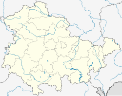
Ubicación en el estado de Turingia | ||
 Ubicación en el distrito | ||
| Coordenadas | 51°01′10″N 10°37′30″E / 51.019428, 10.625121 | |
| Entidad | Municipio | |
| • País | Alemania | |
| • Estado | Turingia | |
| • Distrito | Gotha | |
| Superficie | ||
| • Total | 9,99 km² | |
| Altitud | ||
| • Media | 260 m s. n. m. | |
| Población (2017) | ||
| • Total | 658 hab. | |
| • Densidad | 65,8 hab./km² | |
| Huso horario | UTC+01:00 y UTC+02:00 | |
| Código postal | 99869[1] | |
| Prefijo telefónico | 036255 | |
| Matrícula | GTH | |
| Número oficial de comunidad | 16067074 | |
| Sitio web oficial | ||
Wangenheim es un municipio situado en el distrito de Gotha, en el estado federado de Turingia (Alemania), a una altitud de 260 metros. Su población a finales de 2016 era de unos 660 habitantes y su densidad poblacional, 66 hab/km².[2][3]
Se encuentra ubicado a poca distancia al oeste de Erfurt, la capital del estado.
Referencias
[editar]- ↑ Worldpostalcodes.org, código postal n.º 99869.
- ↑ destatis.de Estadísticas de Alemania. Consultado el 12 de junio de 2018
- ↑ statistiks.de Estadísticas de Turingia. Consultado el 12 de junio de 2018
Enlaces externos
[editar]- Página web del distrito de Gotha
- Esta obra contiene una traducción derivada de «Wangenheim» de Wikipedia en inglés, publicada por sus editores bajo la Licencia de documentación libre de GNU y la Licencia Creative Commons Atribución-CompartirIgual 4.0 Internacional.
 Wikimedia Commons alberga una categoría multimedia sobre Wangenheim.
