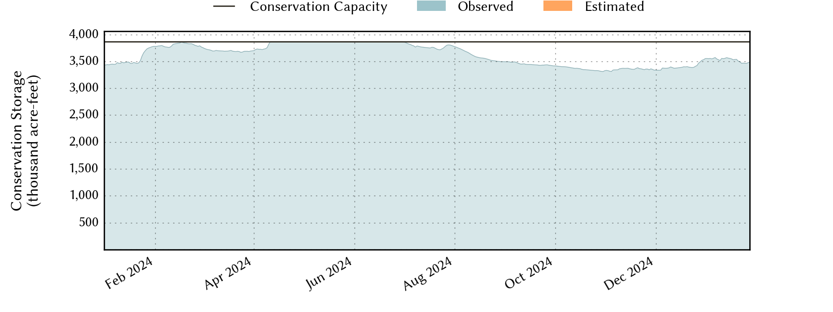
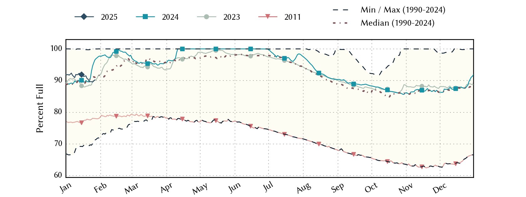
Sabine River Basin Reservoirs: Monitored Water Supply Reservoirs are 89.8% full on 2025-01-26
Historical Data
| Date | Percent Full |
Reservoir Storage (acre-ft) |
Conservation Storage (acre-ft) |
Conservation Capacity (acre-ft) |
|
|---|---|---|---|---|---|
| Today | 2025-01-26 | 89.8 | 5,473,553 | 3,472,256 | 3,867,301 |
| Yesterday | 2025-01-25 | 89.5 | 5,453,748 | 3,462,031 | 3,867,301 |
| 2 days ago | 2025-01-24 | 89.6 | 5,461,391 | 3,466,263 | 3,867,301 |
| 1 week ago | 2025-01-19 | 91.5 | 5,595,408 | 3,537,088 | 3,867,301 |
| 1 month ago | 2024-12-26 | 88.5 | 5,418,397 | 3,422,156 | 3,867,301 |
| 3 months ago | 2024-10-26 | 86.1 | 5,224,980 | 3,328,690 | 3,867,301 |
| 6 months ago | 2024-07-26 | 97.6 | 5,967,351 | 3,773,464 | 3,867,301 |
| 1 year ago | 2024-01-26 | 95.6 | 5,856,539 | 3,697,966 | 3,867,301 |
*
Percent Full is based on Conservation Storage and Conservation Capacity and doesn't account for storage in flood pool.
Reservoir Storage
| Reservoir | Percent Full |
Water Level (ft) |
Height Above Conservation Pool (ft) |
Reservoir Storage (acre-ft) |
Conservation Storage (acre-ft) |
Conservation Capacity (acre-ft) |
Surface Area (acres) |
|---|---|---|---|---|---|---|---|
| Cherokee | 100.0 | 280.34 | 0.34 | 46,190 | 40,094 | 40,094 | - n.a. - |
| Fork | 92.6 | 401.26 | -1.74 | 591,865 | 560,422 | 605,061 | 24,935 |
| Martin | 100.0 | 306.00 | 0.00 | 75,726 | 75,726 | 75,726 | 4,954 |
| Murvaul | 100.0 | 265.47 | 0.17 | 38,870 | 38,285 | 38,285 | - n.a. - |
| Tawakoni | 91.6 | 435.47 | -2.03 | 798,672 | 798,664 | 871,685 | 35,099 |
| Toledo Bend 1 | 87.6 | 168.63 | -3.37 | 3,922,230 | 1,959,065 | 2,236,450 | 166,350 |
footnotes
1
Toledo Bend Reservoir straddles the border of Texas and Louisiana, Texas has rights to 50% of Toledo Bend Reservoir's total conservation capacity. Percent full, conservation storage and conservation capacity are based on the Texas share.


