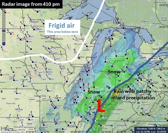
As the region was waiting for the arrival of bitterly cold air, some of the coldest temperatures we would have seen in a number of years, a low pressure system had to move northeast across the Ohio Valley and to the eastern Great Lakes first. This low deepened significantly and brought warm air up into the Upper Ohio Valley Sunday night (Jan 5). Rain and a wintry mix of precipitation pressed as far west as Sandusky and Marion. Just a bit further west where it stayed cold enough for the precipitation to stay as snow, heavy snow fell and snowfall rates were at an inch an hour for most of the evening. The snowfall accumulations varied from 10+ inches between Toledo and Findlay to just over 1 inch 20 to 30 miles to the east. Toledo Express Airport measured 13.0 inches from this storm. After the low and the cold front passed, the surge of cold arctic air was able to move into the area.


Radar and surface observations from 410pm EST Jan 5 Radar from 648 pm EST Jan 5
Temperatures fell throughout the day Monday (1/6) and Monday night. Winds picked up and gusted to 30-35 MPH at times. This created a dangerous wind chill situation (wind chill values from -35F to -45F) where in a matter of 10 minutes or less exposed skin would become frostbitten. This cold outbreak was unique because we had both the record low temperatures and wind to yield the extreme wind chills. By Tuesday morning (1/7) temperatures were beginning to rebound and by Tuesday night the winds were beginning to relax.
| Low 1/6/14 (°F) | Record (°F) (year) | Low 1/7/14 (°F) | Record (°F) (year) | |
|---|---|---|---|---|
| Cleveland | -11 | -9 (1884) | -11 | -7 (1884) |
| Toledo | -15 | -14 (1884) | -14 | -6 (1970) |
| Erie | -9 | -3 (1996) | -10 | -3 (1970) |
| Mansfield | -13 | -12 (1924) | -12 | -7 (1940) |
| Akron-Canton | -10 | -9 (1924) | -11 | -5 (1942) |
| Youngstown | -11 | -2 (1988) | -12 | -6 (1988) |
In addition to the closure of schools, some businesses also closed for the extreme temperatures or because of failures/outages due to the cold weather.
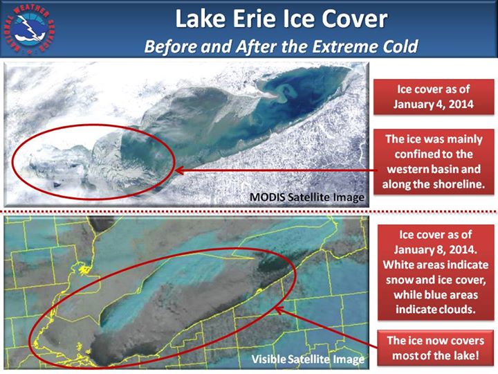
Over the course of 4 days, Lake Erie became nearly covered in ice. See the images below:
