Charleston, WV
Weather Forecast Office
|
Local Weather History For January 8th...
|
|
In 1797, the Ohio River was frozen along its entire length.
|
Daily temperature and precipitation maps covering the past 24 hours from 7 A.M. to 7 A.M. EST/EDT. Snow depth is based on measurement at 7 A.M. of the day shown. Maps are generally updated around 10:30 A.M. each day. Ranked listings by state of the individual station reports is provided on our full climate maps page at http://www.weather.gov/rlx/climatemaps.
| Max Temp | Min Temp | Precip | Snowfall | Snow Depth |
 |
 |
 |
 |
 |
Select drop-down menu for other sites and months
|
|
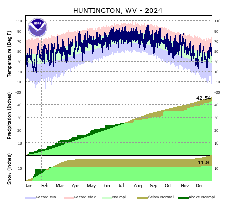
Huntington, WV |
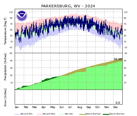
Parkersburg, WV |
|
Clarksburg, WV |
Elkins, WV |
Beckley, WV |
Warnings/Hazards
Local Briefing
Hazard Outlooks
Report Severe Weather
Winter Storm Severity Index
Hazards Criteria
Winter Weather
Observations
Current Weather Briefing
Observations (List)
Local Radar
Regional Radar
Satellite
Rain Gauge Monitoring
Snowfall Reports
Ice Reports
Local Storm Reports
Public Information Statements
Forecasts
Forecast Discussion
Local Zone Forecast
Graphical Forecasts
User Defined Area
Hourly Forecasts
Activity Planner
Local Aviation Weather
Local Fire Weather
Winter Weather
Long Range Outlooks
Rivers and Lakes
River Observations
River Forecasts
River/Lake Summary
River Monitor
Hydrograph Dashboard
Ensemble River Guidance
Ensemble Dashboard
US Dept of Commerce
National Oceanic and Atmospheric Administration
National Weather Service
Charleston, WV
1754 Hendrickson Drive
South Charleston, WV 25303
(304) 356-5885
Comments? Questions? Please Contact Us.


