Ficheiro:Oceania (orthographic projection).svg
Aparencia

Tamaño desta vista previa en PNG do ficheiro en formato SVG: 541 × 541 píxeles. Outras resolucións: 240 × 240 píxeles | 480 × 480 píxeles | 768 × 768 píxeles | 1.024 × 1.024 píxeles | 2.048 × 2.048 píxeles.
Ficheiro orixinal (ficheiro SVG; resolución de 541 × 541 píxeles; tamaño do ficheiro: 63 kB)
Historial do ficheiro
Prema nunha data/hora para ver o ficheiro tal e como estaba nese momento.
| Data/Hora | Miniatura | Dimensións | Usuario | Comentario | |
|---|---|---|---|---|---|
| actual | 6 de febreiro de 2023 ás 18:54 |  | 541 × 541 (63 kB) | Golden Mage | A change to the map of Asia will first face debate from others. Hence, a change to the commonly accepted map of Oceania cannot be made without a wider consensus. |
| 6 de febreiro de 2023 ás 06:33 | 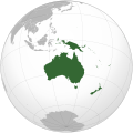 | 541 × 541 (108 kB) | Kwamikagami | rv: then perhaps we need to change the Asia map to match. This is as defined in WP. | |
| 5 de febreiro de 2023 ás 18:19 | 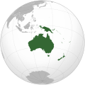 | 541 × 541 (63 kB) | Golden Mage | Reverted to the map that displays the more accepted definition of Oceania's boundaries. Widely accepted geopolitical definitions take precedence over mere geographical ones. The map of the Wikipedia page for Asia already includes the Maluku Islands. | |
| 5 de febreiro de 2023 ás 05:01 | 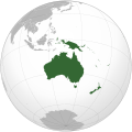 | 541 × 541 (108 kB) | Treetoes023 | Reverted to version as of 06:27, 24 December 2022 (UTC) | |
| 5 de febreiro de 2023 ás 05:00 | 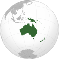 | 541 × 541 (63 kB) | Treetoes023 | Reverted to version as of 13:25, 31 December 2022 (UTC) | |
| 5 de febreiro de 2023 ás 04:55 |  | 541 × 541 (108 kB) | Treetoes023 | Reverted to version as of 00:31, 4 December 2022 (UTC) | |
| 31 de decembro de 2022 ás 13:25 |  | 541 × 541 (63 kB) | Golden Mage | Reverted to the map that displays the more accepted definition of Oceania's boundaries. Widely accepted geopolitical definitions take precedence over mere geographical ones. | |
| 24 de decembro de 2022 ás 06:27 |  | 541 × 541 (108 kB) | Kwamikagami | Reverted to version as of 00:31, 4 December 2022 (UTC) definition per WP-en | |
| 22 de decembro de 2022 ás 06:13 |  | 541 × 541 (63 kB) | Golden Mage | Reverted to the map that displays the more accepted definition of Oceania's boundaries. | |
| 4 de decembro de 2022 ás 00:31 | 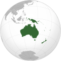 | 541 × 541 (108 kB) | Kwamikagami | the Weber line divides Oceanic from Asian Wallacea | |
| 3 de maio de 2021 ás 06:37 | 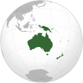 | 541 × 541 (63 kB) | Kwamikagami | Reverted to version as of 17:02, 19 September 2016 (UTC) Papua is not in Asia by any definition | |
| 13 de abril de 2021 ás 19:06 | 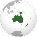 | 541 × 541 (72 kB) | Cupcake547 | Reverted to version as of 20:33, 12 September 2012 (UTC) West Papua is part of Asia | |
| 19 de setembro de 2016 ás 17:02 | 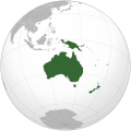 | 541 × 541 (63 kB) | Tholme | Scrubbed with http://codedread.com/scour/ | |
| 5 de novembro de 2013 ás 21:04 | 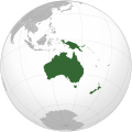 | 541 × 541 (258 kB) | Ischa1 | Western New Guinea belongs to Oceania. | |
| 12 de setembro de 2012 ás 20:33 | 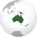 | 541 × 541 (72 kB) | Palosirkka | Scrubbed with http://codedread.com/scour/ | |
| 25 de outubro de 2010 ás 15:40 | 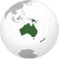 | 541 × 541 (313 kB) | Kwamikagami | Reverted to version as of 11:37, 30 January 2010--articles are about geopolitical Oceania, which excludes W Papua | |
| 21 de outubro de 2010 ás 19:34 | 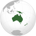 | 541 × 541 (258 kB) | Gadfium | Revert to earlier version which does not include Malay archipelago. See talk page. | |
| 18 de outubro de 2010 ás 10:26 |  | 541 × 541 (284 kB) | Kwamikagami | m: file fmt only | |
| 18 de outubro de 2010 ás 08:07 |  | 541 × 541 (318 kB) | Kwamikagami | Added Malay Archipelago, which is included in Oceania as often as Australia is (core Oceania includes neither) | |
| 11 de febreiro de 2010 ás 11:47 |  | 541 × 541 (258 kB) | Bosonic dressing | Reverted to version as of 11:36, 30 January 2010 |
Uso do ficheiro
As seguintes 79 páxinas usan este ficheiro:
- Adamstown
- Agaña
- Alofi
- América
- América do Norte
- América do Sur
- Antártida
- Apia
- Armórica (continente)
- Asia
- Atlántida
- Atol Fakaofo
- Atol de Midway
- Australia
- Avalonia
- Avarua
- Báltica
- Camberra
- Casaquistania
- Continente
- Dili
- Estados Federados de Micronesia
- Eurafrasia
- Eurasia
- Europa
- Fidxi
- Flying Fish Cove
- Funafuti
- Gondwana
- Hanga Roa
- Honiara
- Honolulu
- Illa de Pascua
- Illas Marianas do Norte
- Illas Marshall
- Illas Salomón
- Kiribati
- Laurasia
- Laurentia
- Laurusia
- Lemuria (continente)
- Majuro
- Matāʻutu
- Nauru
- Niue
- Nouméa
- Nova Zelandia
- Nukuʻalofa
- Oceanía
- Pago Pago
- Palau
- Palikir
- Pannotia
- Panxea
- Papeete
- Papúa Nova Guinea
- Port Moresby
- Port Vila
- Reino de Nova Zelandia
- Rodinia
- Sahul
- Saipan
- Samoa
- Siberia (continente)
- Subcontinente indio
- Suva
- Tarawa Sur
- Tokelau
- Tonga
- Tuvalu
- Vanuatu
- Wellington
- West Island
- Yaren
- África
- Usuario:Prevert/modelos xeografía
- Modelo:Capitais de Oceanía
- Modelo:Continentes
- Modelo:Oceanía
Uso global do ficheiro
Os seguintes wikis empregan esta imaxe:
- Uso en ab.wikipedia.org
- Uso en ady.wikipedia.org
- Uso en af.wikipedia.org
- Afrika
- Asië
- Europa
- Kiribati
- Noord-Amerika
- Suid-Amerika
- Vanuatu
- Guam
- Nieu-Seeland
- Sjabloon:Kontinente
- Australië
- Nauru
- Wellington, Nieu-Seeland
- Hoofstad
- Lys van hoofstede
- Sjabloon:Lande van Oseanië
- Honolulu
- Antarktika
- Gondwana
- Eurasië
- Laurasië
- Kategorie:Lande in Oseanië
- Lys van lande
- Fidji
- Canberra
- Hawaii
- Lys van nasionale leuses
- Clipperton
- Oseanië
- Norfolkeiland
- Amerikas
- Tonga
- Tuvalu
- Sjabloon:Hoofstede in Oseanië
- Palau
- Australië (kontinent)
- Afrika-Eurasië
- Samoa
- Marshalleilande
- Salomonseilande
- Papoea-Nieu-Guinee
- Gefedereerde State van Mikronesië
- Nukuʻalofa
- Port Moresby
- Apia
- Funafuti
- Honiara
- Majuro
Ollar o uso global deste ficheiro.
